Search results
From XMS Wiki
Jump to navigationJump to search
- ...thumb|none|left|550 px|HY8 Modeling Wizard showing the ''Define and Smooth Streams'' step.]] When building a GSSHA model, define the parameters for and smooth all the streams in the model before building the 2D grid. When the 2D grid is generated, t2 KB (348 words) - 19:55, 4 May 2020
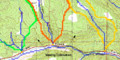
File:TOPAZ Delineation.png Delineation from the TOPAZ results only (not including the roads as streams)(688 × 343 (64 KB)) - 15:52, 7 December 2016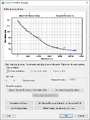
File:Smooth GSSHA Streams dialog.png The smooth GSSHA streams dialog(499 × 667 (23 KB)) - 18:24, 3 November 2022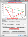
File:GsshaStormDrainElevationInterpFig2.png The Interpolate Selected Points button in the GSSHA Smooth Streams dialog(513 × 673 (30 KB)) - 14:38, 5 June 2019
File:HydrologicModelingWizardDefineAndSmoothStreams.jpg HY8 Modeling Wizard showing the Define and Smooth Streams step.(679 × 514 (76 KB)) - 15:58, 15 December 2015
File:Tin3.jpg By using GIS Vector data to establish streams and a "rough" boundary, a TIN well-suited for basin delineation can be crea(350 × 368 (31 KB)) - 16:27, 9 January 2017
File:Demtofobj.jpg ...using a DEM, the results are always converted to points (outlets), lines (streams), and polygons (boundaries) for more convenient data storage and manipulati(350 × 400 (56 KB)) - 15:39, 9 January 2017- The ''Watershed from Raster'' tool derives a watershed and its streams locations from an elevation raster and one or more outlet locations. This i ...t_book/available_tools/stream_network_analysis.html#ExtractStreams Extract Streams]''4 KB (515 words) - 19:40, 26 October 2023
- * [[WMS:Streams|Streams]]1 KB (160 words) - 23:05, 30 December 2019
- ...using a DEM, the results are always converted to points (outlets), lines (streams), and polygons (boundaries) for more convenient data storage and manipulati468 bytes (66 words) - 15:50, 11 April 2017
- ...er. They appear similar to stream feature arcs, but are not. On a TIN the streams are defined simply as connected vertices. ==Create Streams==4 KB (662 words) - 21:56, 30 December 2019
- [[WMS:Define and Smooth Streams|Define and Smooth Streams]] ·1 KB (148 words) - 14:52, 11 April 2017
- ...ions coverage containing a stream network is provided, the cells where the streams intersect the grid are not altered. For more information on cleandam.exe, r ...containing the stream network. Optional. If provided, cells intersected by streams are not altered.1 KB (172 words) - 22:38, 16 April 2024
- ..._ugrids_from_watersheds_1.png|thumb|none|500 px| Input watershed polygons, streams, and raster.]] This tool converts the watershed boundaries and streams to UGrids and assigns elevations to the UGrids as follows:2 KB (348 words) - 15:47, 24 October 2023
- ...will cause the streams to be denser while higher values will create fewer streams in the completed model.2 KB (230 words) - 18:05, 15 January 2024
- * [[WMS:Streams|Streams]]1 KB (203 words) - 14:28, 14 March 2017
- ...ordered by selecting the downstream most point and choosing the '''Reorder Streams''' command from the ''Feature Objects'' menu), and then convert the coverag2 KB (270 words) - 15:33, 29 September 2017
- ...udes points, lines, and polygons that are used in WMS to represent basins, streams, and key points such as outlets or culverts. In WMS we refer to this GIS da ...database, or it may be straight-forward to trace an existing map to define streams and basins. With WMS, properly structured hydrologic models can be created4 KB (742 words) - 16:00, 26 October 2017
- ...File|Save GSSHA Project File]]{{·}}[[WMS:Smooth GSSHA Streams|Smooth GSSHA Streams]]{{·}}[[WMS:GSSHA Snowmelt Options|Snowmelt]]{{·}}Solution ([[WMS:GSSHA S2 KB (303 words) - 21:52, 21 May 2019
- ...ns can be included when computing the cell elevation dataset (see “Include streams in cell elevations” below). *''Include streams in cell elevations'' – If selected, and the boundary conditions cover2 KB (297 words) - 22:41, 16 April 2024


