Search results
From XMS Wiki
Jump to navigationJump to search
Page title matches
File:Smooth GSSHA Streams dialog.png The smooth GSSHA streams dialog(499 × 667 (23 KB)) - 18:24, 3 November 2022

Page text matches
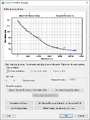
File:SmoothStreams.png The smooth GSSHA streams dialog See also [[File:Smooth GSSHA Streams dialog.png|thumb|none]](503 × 593 (20 KB)) - 18:40, 22 May 2019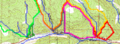
File:RoadAsStreamsDelineation.png ...neation after including the roads as streams. It is important to note that streams have been made in both directions from the outlets in order to "capture" th(800 × 295 (403 KB)) - 15:52, 7 December 2016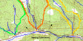
File:TOPAZ Delineation.png Delineation from the TOPAZ results only (not including the roads as streams)(688 × 343 (64 KB)) - 15:52, 7 December 2016File:Smooth GSSHA Streams dialog.png The smooth GSSHA streams dialog(499 × 667 (23 KB)) - 18:24, 3 November 2022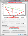
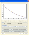
File:GsshaStormDrainElevationInterpFig2.png The Interpolate Selected Points button in the GSSHA Smooth Streams dialog(513 × 673 (30 KB)) - 14:38, 5 June 2019
File:HydrologicModelingWizardDefineAndSmoothStreams.jpg HY8 Modeling Wizard showing the Define and Smooth Streams step.(679 × 514 (76 KB)) - 15:58, 15 December 2015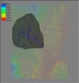
File:Tin3.jpg By using GIS Vector data to establish streams and a "rough" boundary, a TIN well-suited for basin delineation can be crea(350 × 368 (31 KB)) - 16:27, 9 January 2017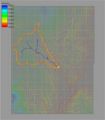
File:Demtofobj.jpg ...using a DEM, the results are always converted to points (outlets), lines (streams), and polygons (boundaries) for more convenient data storage and manipulati(350 × 400 (56 KB)) - 15:39, 9 January 2017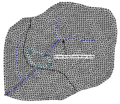
File:TriangulatedDrainageCoverage.png ...it is difficult if not impossible to ensure that triangle edges conform to streams, ridges and other drainage features. Drainage coverage feature objects can(329 × 285 (18 KB)) - 14:19, 3 May 2016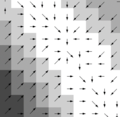
File:DEM Guidelines 2.png ...lues since the flow paths of all "upstream" points will pass through them. Streams are easily identified by displaying all DEM points with a flow accumulation(377 × 367 (72 KB)) - 16:02, 9 June 2016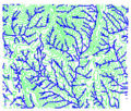
File:DEM Guidelines 3.jpg ...lues since the flow paths of all "upstream" points will pass through them. Streams are easily identified by displaying all DEM points with a flow accumulation(284 × 241 (74 KB)) - 16:55, 21 August 2014


