File:GSDA AndersonLandClassification.png
From XMS Wiki
Jump to navigationJump to search
Size of this preview: 247 × 599 pixels. Other resolution: 337 × 817 pixels.
Original file (337 × 817 pixels, file size: 88 KB, MIME type: image/png)
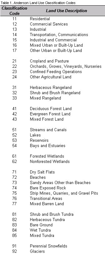
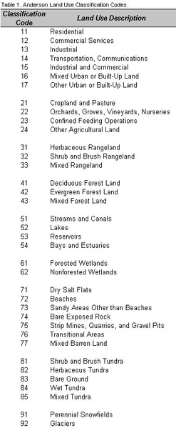
The USGS assigned classification codes to each land use polygon. These code numbers are contained in the ArcView GIS table file under the Lucode field and represent certain land uses.
File history
Click on a date/time to view the file as it appeared at that time.
| Date/Time | Thumbnail | Dimensions | User | Comment | |
|---|---|---|---|---|---|
| current | ★ Approved revision 22:31, 15 May 2008 | 337 × 817 (88 KB) | Eshaw (talk | contribs) |
You cannot overwrite this file.
File usage
The following page uses this file: