Search results
From XMS Wiki
Jump to navigationJump to search
Page title matches

File:Raster Module icon.png [[Category:Module Icons]](15 × 15 (660 bytes)) - 22:41, 15 June 2017
Page text matches
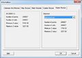
File:SMS Info Raster.jpg [[Category:SMS Raster Dialogs]] [[Category:Raster]](552 × 393 (32 KB)) - 16:02, 10 December 2015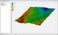
File:Raster4.png [[Category:Raster]] Raster Module Example(800 × 486 (172 KB)) - 16:55, 27 July 2017
File:WMSGISRasterImageTreeIcon.png [[Category:Module Icons]] [[Category:Raster Icons]](16 × 18 (625 bytes)) - 16:04, 2 March 2017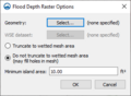
File:GIS Raster to Flood Depth.png ...pths''' right-click command is used on an elevation data raster in the Map module.(311 × 228 (13 KB)) - 18:59, 28 February 2022


