AHGW:What's New in AHGW 2.0.0
The more significant new features in Arc Hydro Groundwater 2.0.0 are listed below.
Subsurface Analyst
With Subsurface Analyst you can create and visualize 3D hydrogeologic models, starting with classification and visualization of borehole logs, creation and editing of cross sections, and generation of 3D volumes.
Create and Edit Cross Sections
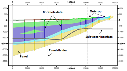
Interactive cross section editing of borehole data.
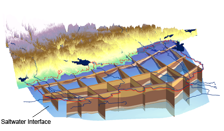
Include water table & saltwater interface and other geologic map data.
2D Cross Sections can be converted to 3D Geosections and viewed in ArcScene. 3D Geosections can also be converted to 2D Cross Sections to edit and view in ArcMap.
The XS2D Wizard creates a new set of feature classes for representing a 2D cross section based on a specific SectionLine feature. The wizard creates a new data frame to which the XS2D feature classes (XS2D_Panel, XS2D_BoreLine, XS2D_PanelDivider, XS2D_MajorGrid, and XS2D_MinorGrid) are added. Using a separate data frame for each 2D cross section allows the features from each cross section to be visualized independently.
Generate 3D Geovolumes
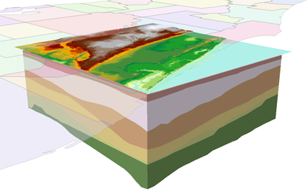
Build 3D GeoVolumes from your subsurface data and visualize the new GeoVolume features in ArcScene.
Classify, Visualize & Edit Borehole Data
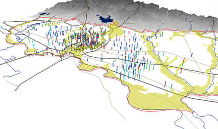
Visualize, classify and edit borehole data such as stratigraphy, screens, and casing interval.
Geoprocessing Tools
New and updated Subsurface Analyst Geoprocessing tools
- The following tools have been added or updated in the Subsurface Analyst Tools:
- Features tools
- Create GeoSection Feature Class
- Create GeoVolume Feature Class
- Create SectionLine Feature Class
- Rasters to GeoSections
- Rasters to GeoVolumes
- TIN tools
- Polygon to TIN
- XS2D Editor
- Create XS2D Boreline Feature Class
- Create XS2D Borelines
- Create XS2D Grid
- Create XS2D Line Feature Class
- Create XS2D Panel Divider
- Create XS2D Panel Feature Class
- Create XS2D_Catalog Table
- Reverse SectionLine Orientation
- Scale Features
- Transform GeoSection to XS2D Panel
- Transform Polygons to XS2D Lines
- Transform Raster to XS2D Line
- Transform XS2D Panel to GeoSection
- Features tools
See also


