Help
Uploads by Rcorrigan
From XMS Wiki
Jump to navigation
Jump to search
This special page shows all uploaded files.
File list
Items per page:
20
50
100
250
500
Username:
Include old versions of files
Go
First page
Previous page
Next page
Last page
Date
Name
Thumbnail
Size
Description
Versions
22:24, 9 May 2022
Arcgispro AddData.png
(
file
)
860 bytes
1
22:25, 9 May 2022
Arcgispro Geoprocssngtools.png
(
file
)
690 bytes
1
15:35, 12 May 2022
ArcGISPro Up.png
(
file
)
1 KB
1
15:38, 12 May 2022
Arcgispro Cntntsdrwingordr.png
(
file
)
742 bytes
1
15:41, 12 May 2022
Arcgispro Dtabasetable.png
(
file
)
634 bytes
1
15:41, 12 May 2022
Arcgispro Dtabseitem.png
(
file
)
712 bytes
1
15:41, 12 May 2022
Arcgispro Slct.png
(
file
)
1 KB
1
22:53, 19 May 2022
Arcgispro tggleallchckbxes.png
(
file
)
636 bytes
1
22:53, 19 May 2022
Arcgispro dtabseflder.png
(
file
)
900 bytes
1
22:53, 19 May 2022
Arcgispro Addallvalus.png
(
file
)
841 bytes
1
22:53, 19 May 2022
Arcgispro Prjct.png
(
file
)
753 bytes
1
21:12, 23 May 2022
Arcgispro Clearftures.png
(
file
)
1 KB
1
22:59, 23 May 2022
Arcgispro prprties.png
(
file
)
825 bytes
1
16:32, 24 May 2022
Arcgispro symbology.png
(
file
)
1 KB
2
19:51, 31 May 2022
Arcgispro symbollyerd.png
(
file
)
827 bytes
1
16:20, 7 June 2022
VectorOptions.jpg
(
file
)
52 KB
2
21:50, 7 June 2022
XY Series Editor.png
(
file
)
28 KB
3
15:53, 7 July 2022
External text MF6.png
(
file
)
685 bytes
1
17:28, 11 August 2022
ArcGIS Pro Red Required Symbol.png
(
file
)
724 bytes
1
17:45, 11 August 2022
ArcGIS Pro Clock.png
(
file
)
1,011 bytes
1
18:15, 11 August 2022
Add to Rster Sries.png
(
file
)
15 KB
1
18:47, 11 August 2022
ArcGIS Pro Assign HydroID GW.png
(
file
)
14 KB
1
20:19, 11 August 2022
ArcGIS Pro Create Blnk AHGW Geodtabse.png
(
file
)
31 KB
2
20:41, 11 August 2022
ArcGIS Pro Create Unique ID Table.png
(
file
)
11 KB
1
20:46, 11 August 2022
ArcGIS Pro Create AHGW Raster Catalog.png
(
file
)
15 KB
2
21:11, 11 August 2022
ArcGIS Pro Make Time Series Statistics.png
(
file
)
26 KB
1
21:29, 11 August 2022
ArcGIS Pro Reset.png
(
file
)
891 bytes
1
22:23, 11 August 2022
ArcGIS Pro Modify AHGW Geodtabse.png
(
file
)
38 KB
1
22:44, 11 August 2022
ArcGIS Pro Warning Red.png
(
file
)
1 KB
1
22:54, 11 August 2022
ArcGIS Pro Create Well Feature Class.png
(
file
)
10 KB
1
16:17, 15 August 2022
ArcGIS Pro Create Time Series Table.png
(
file
)
11 KB
1
16:46, 15 August 2022
ArcGIS Pro Borehole Data to Points.png
(
file
)
24 KB
1
17:02, 15 August 2022
Arcgispro crclechev.png
(
file
)
1 KB
1
18:11, 15 August 2022
ArcGIS Pro BoreholeLog Table to Points.png
(
file
)
23 KB
2
18:53, 15 August 2022
ArcGIS Pro Create Borelines.png
(
file
)
24 KB
1
20:31, 15 August 2022
ArcGIS Pro Create Borepoints.png
(
file
)
12 KB
1
20:49, 15 August 2022
ArcGIS Pro Create GeoSection Feature Class.png
(
file
)
12 KB
1
21:14, 15 August 2022
ArcGIS Pro Create GeoVolume Feature Class.png
(
file
)
12 KB
1
21:38, 15 August 2022
ArcGIS Pro Create Non Vertical Borelines.png
(
file
)
14 KB
1
21:57, 15 August 2022
ArcGIS Pro Create SectionLine Feature Class.png
(
file
)
12 KB
1
22:23, 15 August 2022
ArcGIS Pro Desurvey Borelog.png
(
file
)
25 KB
1
23:00, 15 August 2022
ArcGIS Pro GeoSection to Points.png
(
file
)
16 KB
1
16:00, 16 August 2022
ArcGIS Pro Rasters to GeoSections.png
(
file
)
21 KB
1
17:25, 16 August 2022
ArcGIS Pro Rasters to GeoVolumes.png
(
file
)
22 KB
2
17:52, 16 August 2022
ArcGIS Pro Polygon to TIN.png
(
file
)
16 KB
2
18:29, 16 August 2022
ArcGIS Pro Create XS2D Boreline Feature Class.png
(
file
)
16 KB
1
19:46, 16 August 2022
ArcGIS Pro Create XS2D BoreLines.png
(
file
)
21 KB
1
20:52, 16 August 2022
ArcGIS Pro Create XS2D Geophysical Plot Feature Class.png
(
file
)
14 KB
1
21:35, 16 August 2022
ArcGIS Pro Create XS2D Geophysical Plot Features.png
(
file
)
39 KB
1
22:34, 16 August 2022
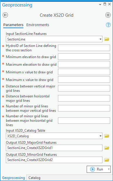
ArcGIS Pro Create XS2D Grid.png
(
file
)
32 KB
1
First page
Previous page
Next page
Last page
Navigation menu
Page actions
Special page
Page actions
Special page
Tools
Personal tools
English
Create account
Log in
XMS Projects
XMS
GMS
SMS
WMS
AHGW
CityWater
Search
Links
Aquaveo
Downloads
Licensing
Training
Consulting
Help
Tools
User contributions
Logs
View user groups
Special pages
Printable version


