Search results
From XMS Wiki
Jump to navigationJump to search
Page title matches
- #REDIRECT [[WMS:Drainage Tools]]32 bytes (4 words) - 16:02, 6 August 2013
- #REDIRECT [[WMS:Drainage Tools]]32 bytes (4 words) - 16:02, 6 August 2013
- ...this drainage coverage. Most of the work done will be centered around the drainage coverage which has two different purposes as outlined in the following para ...rainage polygon is tied into the tree as a drainage basin. An example of a drainage coverage used for the purpose of creating a hydrologic model is shown in th7 KB (1,099 words) - 15:31, 29 September 2017
- Articles related to the Drainage module.34 members (2 subcategories, 24 files) - 16:14, 18 February 2014
- #REDIRECT [[WMS:Drainage Tools]]32 bytes (4 words) - 16:02, 6 August 2013
- #REDIRECT [[WMS:Drainage Tools]]32 bytes (4 words) - 16:03, 6 August 2013
- [[File:WMSIcon Drainage Palette.png|thumb|right|The toolbar for the Drainage module.]] The toolbar for the WMS [[WMS:Drainage Module|Drainage module]] has a variety of tools useful for editing and creating objects wit3 KB (434 words) - 23:00, 13 May 2021
- 38 bytes (5 words) - 16:24, 1 June 2015
- Files and articles related to dialogs in the drainage module [[Category:Drainage]]8 members (0 subcategories, 7 files) - 15:25, 16 December 2015
- ...basin boundaries from digital elevation sources such as TINs and DEMs. The Drainage module includes all of the commands necessary to perform the automated deli The Drainage module is included with all [http://www.aquaveo.com/software/wms-pricing pa3 KB (430 words) - 20:33, 17 December 2019
- #REDIRECT [[WMS:Drainage]]26 bytes (3 words) - 15:45, 6 August 2013
- #REDIRECT [[WMS:Drainage]]26 bytes (3 words) - 16:54, 7 August 2013
- #REDIRECT [[WMS:Drainage Tools]]32 bytes (4 words) - 16:02, 6 August 2013
- #REDIRECT [[WMS:Drainage]]26 bytes (3 words) - 16:54, 7 August 2013
- #REDIRECT [[WMS:Drainage Tools]]32 bytes (4 words) - 16:02, 6 August 2013
- #REDIRECT [[WMS:Drainage]]26 bytes (3 words) - 16:54, 7 August 2013
- #REDIRECT [[WMS:Drainage Tools]]32 bytes (4 words) - 16:04, 6 August 2013
- 38 bytes (5 words) - 16:24, 1 June 2015
- #REDIRECT [[WMS:Drainage]]26 bytes (3 words) - 16:54, 7 August 2013
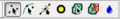
File:WMSIcon Drainage Palette.png [[Category:Drainage]] Drainage Module tool palette(171 × 27 (3 KB)) - 15:54, 26 April 2018
Page text matches

File:WMS SelectDrainageUnitTool.svg [[Category:Drainage]] [[Category:WMS Drainage Module Tool Icons]](60 × 66 (7 KB)) - 23:26, 17 January 2018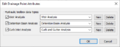
File:WMS Edit Drainage Point Att.png [[Category:Drainage]] [[Category:Drainage Dialogs]](494 × 193 (11 KB)) - 18:27, 22 June 2023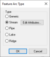
File:WMS Drainage Feature Arc Type.png [[Category:Drainage]] [[Category:Drainage Dialogs]](200 × 232 (4 KB)) - 18:23, 22 June 2023
File:WMSIcon Select Drainage Unit.png [[Category:Drainage]] [[Category:WMS Drainage Module Tool Icons]](16 × 16 (830 bytes)) - 16:25, 19 January 2018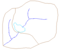
File:DrainageCoverage.png [[Category:Drainage]] A drainage coverage used for the purpose of creating a hydrologic model.(317 × 266 (3 KB)) - 14:21, 3 May 2016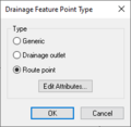
File:WMS Drainage Feature Point Type.png [[Category:Drainage]] [[Category:Drainage Dialogs]](221 × 216 (4 KB)) - 18:24, 22 June 2023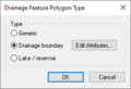
File:WMS Drainage Feature Polygon Type.png [[Category:Drainage]] [[Category:Drainage Dialogs]](266 × 182 (4 KB)) - 18:25, 22 June 2023
File:WMS Edit Stream Arc Attributes.png [[Category:Drainage]] [[Category:Drainage Dialogs]](512 × 217 (13 KB)) - 18:28, 22 June 2023File:WMSIcon Drainage Palette.png [[Category:Drainage]] Drainage Module tool palette(171 × 27 (3 KB)) - 15:54, 26 April 2018- Files and articles related to dialogs in the drainage module [[Category:Drainage]]8 members (0 subcategories, 7 files) - 15:25, 16 December 2015
File:WMS Edit Basin Polygon Att.png [[Category:Drainage]] [[Category:Drainage Dialogs]](512 × 139 (6 KB)) - 18:26, 22 June 2023
File:WMS FlowPathTool.svg [[Category:Drainage]] [[Category:WMS Drainage Module Tool Icons]](30 × 45 (3 KB)) - 23:27, 17 January 2018- Icons used in the [[WMS:Drainage Tools|WMS Drainage Module toolbar]]. [[Category:Drainage]]16 members (0 subcategories, 16 files) - 14:58, 10 May 2017

File:WMSIcon Move Basin Labels.png [[Category:Drainage]] [[Category:WMS Drainage Module Tool Icons]](16 × 16 (767 bytes)) - 16:24, 19 January 2018
File:WMSIcon Flow Path.png [[Category:Drainage]] [[Category:WMS Drainage Module Tool Icons]](10 × 16 (469 bytes)) - 16:24, 19 January 2018
File:WMS MoveBasinLabels.svg [[Category:Drainage]] [[Category:WMS Drainage Module Tool Icons]](60 × 64 (7 KB)) - 23:27, 17 January 2018- ...basin boundaries from digital elevation sources such as TINs and DEMs. The Drainage module includes all of the commands necessary to perform the automated deli The Drainage module is included with all [http://www.aquaveo.com/software/wms-pricing pa3 KB (430 words) - 20:33, 17 December 2019

File:Create Outlet Point tool in WMS.png [[Category:Drainage]] [[Category:WMS Drainage Module Tool Icons]](16 × 16 (554 bytes)) - 16:24, 19 January 2018
File:Drainage Module Icon.svg Drainage Module icon in WMS. Replacing [[File:Drainage Module icon in WMS.png]](60 × 64 (5 KB)) - 20:36, 15 November 2017
File:Drainage Module icon in WMS.png Drainage Module icon in WMS. [[Category:WMS Drainage Module Tool Icons]](16 × 16 (884 bytes)) - 15:11, 8 June 2017


