Search results
From XMS Wiki
Jump to navigationJump to search
Page title matches
- ...gic soil type, whereas for runoff coefficients the critical attribute is a soil ID that can be related to a table of runoff coefficients. ...o the attributes of the feature polygon in order to extract the hydrologic soil group parameter. In previous versions of WMS, this step had to be done outs2 KB (256 words) - 21:58, 18 December 2019
- #REDIRECT [[WMS:Soil Type Coverage]]36 bytes (5 words) - 21:57, 18 December 2019
- 40 bytes (5 words) - 18:44, 16 September 2013
- #REDIRECT [[WMS:Soil Type Coverage]]36 bytes (5 words) - 21:57, 18 December 2019
- #REDIRECT [[WMS:Soil Type Coverage]]36 bytes (5 words) - 21:57, 18 December 2019
- #REDIRECT [[WMS:Soil Type Runoff Coefficient Files]]52 bytes (7 words) - 16:45, 2 October 2013
- Like land use, soil type coverages/grids can be used to map model parameters. Tables with correspond |+ align="bottom"|''Figure 1. Soil Type Runoff Coefficient File Format''2 KB (242 words) - 16:04, 24 February 2016
- #REDIRECT [[WMS:Soil Type Runoff Coefficient Files]]52 bytes (7 words) - 16:45, 2 October 2013
- #REDIRECT [[WMS:Soil Type Runoff Coefficient Files]]52 bytes (7 words) - 16:45, 2 October 2013
- #REDIRECT [[WMS:Soil Type Runoff Coefficient Files]]52 bytes (7 words) - 16:45, 2 October 2013
- #REDIRECT [[WMS:Soil Type Runoff Coefficient Files]]52 bytes (7 words) - 16:46, 2 October 2013
Page text matches
- ...gic soil type, whereas for runoff coefficients the critical attribute is a soil ID that can be related to a table of runoff coefficients. ...o the attributes of the feature polygon in order to extract the hydrologic soil group parameter. In previous versions of WMS, this step had to be done outs2 KB (256 words) - 21:58, 18 December 2019
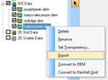
File:RasterDataExport.png ...rmation about land use or soil type can be converted to a land use or soil type grid by right-clicking on the layer.(336 × 250 (9 KB)) - 15:10, 20 February 2017- Like land use, soil type coverages/grids can be used to map model parameters. Tables with correspond |+ align="bottom"|''Figure 1. Soil Type Runoff Coefficient File Format''2 KB (242 words) - 16:04, 24 February 2016
- ...e done using soil type coverages and the parameters that must be linked to soil IDs: #Hydrologic soil group to map SCS Curve Numbers (requires the use of a land use coverage as3 KB (500 words) - 21:56, 18 December 2019
- #REDIRECT [[WMS:Soil Type]]27 bytes (4 words) - 16:47, 28 August 2013
- #REDIRECT [[WMS:Soil Type Coverage]]36 bytes (5 words) - 21:57, 18 December 2019
- #REDIRECT [[WMS:Soil Type Coverage]]36 bytes (5 words) - 21:56, 18 December 2019
- #REDIRECT [[WMS:Soil Type Coverage]]36 bytes (5 words) - 21:57, 18 December 2019
- #REDIRECT [[WMS:Soil Type Coverage]]36 bytes (5 words) - 21:57, 18 December 2019
- #REDIRECT [[WMS:Soil Type Coverage]]36 bytes (5 words) - 21:57, 18 December 2019
- #REDIRECT [[WMS:Soil Type Runoff Coefficient Files]]52 bytes (7 words) - 16:46, 2 October 2013
- #REDIRECT [[WMS:Soil Type Runoff Coefficient Files]]52 bytes (7 words) - 16:46, 2 October 2013
- #REDIRECT [[WMS:Soil Type Runoff Coefficient Files]]52 bytes (7 words) - 16:45, 2 October 2013
- #REDIRECT [[WMS:Soil Type Runoff Coefficient Files]]52 bytes (7 words) - 16:45, 2 October 2013
- #REDIRECT [[WMS:Soil Type Runoff Coefficient Files]]52 bytes (7 words) - 16:45, 2 October 2013
- #REDIRECT [[WMS:Soil Type Runoff Coefficient Files]]52 bytes (7 words) - 16:45, 2 October 2013
- #REDIRECT [[WMS:Soil Type Runoff Coefficient Files]]52 bytes (7 words) - 16:46, 2 October 2013
- #REDIRECT [[WMS:Soil Type Runoff Coefficient Files]]52 bytes (7 words) - 16:46, 2 October 2013
- #REDIRECT [[WMS:Soil Type Runoff Coefficient Files]]52 bytes (7 words) - 16:46, 2 October 2013
- #REDIRECT [[WMS:Soil Type Runoff Coefficient Files]]52 bytes (7 words) - 16:46, 2 October 2013
