Search results
From XMS Wiki
Jump to navigationJump to search
Page title matches
- {{TIN links}} TIN stands for Triangulated Irregular Network. TINs are used for surface model2 KB (276 words) - 14:44, 13 September 2017
- Icons used in the TIN Module in GMS [[Category:Module Icons]]13 members (0 subcategories, 13 files) - 14:56, 10 May 2017

File:TIN Module Icon.svg Icon for the TIN module. It is also used in the Project Explorer to indicate TINs in the project tr [[Category:TIN Module Icons]](60 × 60 (4 KB)) - 14:30, 28 August 2017
File:TIN Module Inactive Icon.svg [[Category:TIN Module Icons]](60 × 60 (3 KB)) - 15:51, 9 November 2017
Page text matches
- |name = TIN links |above = {{noprint|[[GMS:TIN Module|TIN Module]]}}1 KB (164 words) - 17:01, 28 November 2017
- ...asic data types supported by GMS. As you switch from one module to another module, the '''Dynamic Tool Palette''' and the '''Menus''' change. This allows you [[File:TIN Module Icon.svg|16 px]] [[GMS:TIN Module|TIN Module]]1 KB (225 words) - 14:24, 7 August 2017
- :[[GMS:Map Module]] :[[GMS:Solid Module]]230 bytes (30 words) - 15:01, 27 October 2017
- [[File:Terraindatamoduleexample.png|thumb|300 px|The Terrain Data module]] ...l terrain data (DEMs, and TINs) for hydrologic and hydraulic modeling. The module contains several [[WMS:Terrain Data Tools|tools]] for thinning, smoothing,1 KB (165 words) - 15:39, 13 December 2019
- {{TIN links}} ...n the TIN in the Graphics Window, or using the following commands in the ''TIN'' menu:2 KB (306 words) - 14:53, 24 October 2017
File:TIN Module Icon.svg Icon for the TIN module. It is also used in the Project Explorer to indicate TINs in the project tr [[Category:TIN Module Icons]](60 × 60 (4 KB)) - 14:30, 28 August 2017- #REDIRECT [[GMS:TIN Module]]28 bytes (4 words) - 17:23, 3 October 2013
- #REDIRECT [[GMS:TIN Module]]28 bytes (4 words) - 17:23, 3 October 2013
- #REDIRECT [[GMS:TIN Module]]28 bytes (4 words) - 17:23, 3 October 2013
- #REDIRECT [[GMS:TIN Module]]28 bytes (4 words) - 17:23, 3 October 2013
- #redirect [[Category:TIN Module Icons]]0 members (0 subcategories, 0 files) - 16:28, 23 May 2017
- !style="text-align:left;"|1. Import vertices to TIN module. :# Right-click on vertices in the TIN module and select the [[GMS:TIN Commands|'''Triangulate''']] menu command.624 bytes (77 words) - 14:11, 13 March 2017

File:Map to TIN Macro.svg Map to TIN macro icon in GMS. [[Category:TIN Module Icons]](60 × 60 (6 KB)) - 14:14, 22 August 2017- The ''TIN'' menu in the Terrain Data module provides commands for converting TIN data into other data. ==TIN to DEM==2 KB (362 words) - 23:02, 30 December 2019
- A TIN is constructed by triangulating a set of vertices. The vertices are connect When a new point is inserted into a TIN, the point is incorporated into the TIN and the edges of the triangles adjacent to the new point are swapped as nec2 KB (314 words) - 20:58, 24 April 2017
- {{TIN links}} ...rder to create a TIN in GMS, there must be a set of TIN vertices. Then the TIN is created by triangulating the vertices (connecting the vertices with line3 KB (477 words) - 17:19, 28 November 2017
- ...Drainage module menus, or in the ''Feature Objects'' Map module menu. If a TIN, DEM, or map data are not present, areas and slopes must be entered interac655 bytes (101 words) - 18:19, 25 February 2013
- ...IN Module|TIN]], [[GMS:2D Mesh Module|2D mesh]], or [[GMS:2D Scatter Point Module|2D scatter points]]. 2D grids can be converted by using the following comma ...s completed allowing the new TIN to be named, assigned a material, and the TIN data can be reviewed.2 KB (274 words) - 15:31, 24 October 2017
- #redirect [[WMS:Project Explorer Contents for Terrain Data Module]] ...change the active module to the Drainage module by selecting the Drainage Module.2 KB (404 words) - 21:18, 17 December 2019
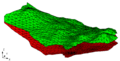
File:Tins.png Example used for the TIN module.(567 × 286 (17 KB)) - 22:51, 8 August 2017

