State Plane Coordinate System
From XMS Wiki
A State Plane system is a coordinate system used in the US. Each US state is divided into one or more zones, known as State Plane zones. Supported State Plane systems include:
- NAD (North American Datum) 1927
- NAD 1983
Additionally, an HPGN (High Precision Geodetic Network, now known as HARN - High Accuracy Precision Network) zone can be specified for each state plane zone.
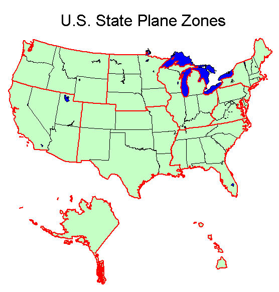
The boundary of most of the state plane zones remained the same from 1927 to 1983. The US State Plane Zones are shown in the map below. The boundaries are shown for each state plane zone by clicking on a region on the map. The boundaries that changed between 1927 and 1983 are highlighted for each state plane zone that changed.
State Zone Maps
Related Topics
Projections | |
|---|---|
| UTM: | Africa • Asia • Australia • Europe • North America • South America |
| State Plane: | Alaska • Hawaii • Mideast • Midwest • New England • Northwest • South Central • Southeast • Southwest • Virginia Area |
| Other | CPP • Geographic |
