File:AHGW Subsurface Analyst XS2D Editor - Create XS2D Geophysical Plot Features for Well.png
From XMS Wiki
Jump to navigationJump to search
Size of this preview: 174 × 599 pixels. Other resolution: 486 × 1,674 pixels.
Original file (486 × 1,674 pixels, file size: 84 KB, MIME type: image/png)
File history
Click on a date/time to view the file as it appeared at that time.
| Date/Time | Thumbnail | Dimensions | User | Comment | |
|---|---|---|---|---|---|
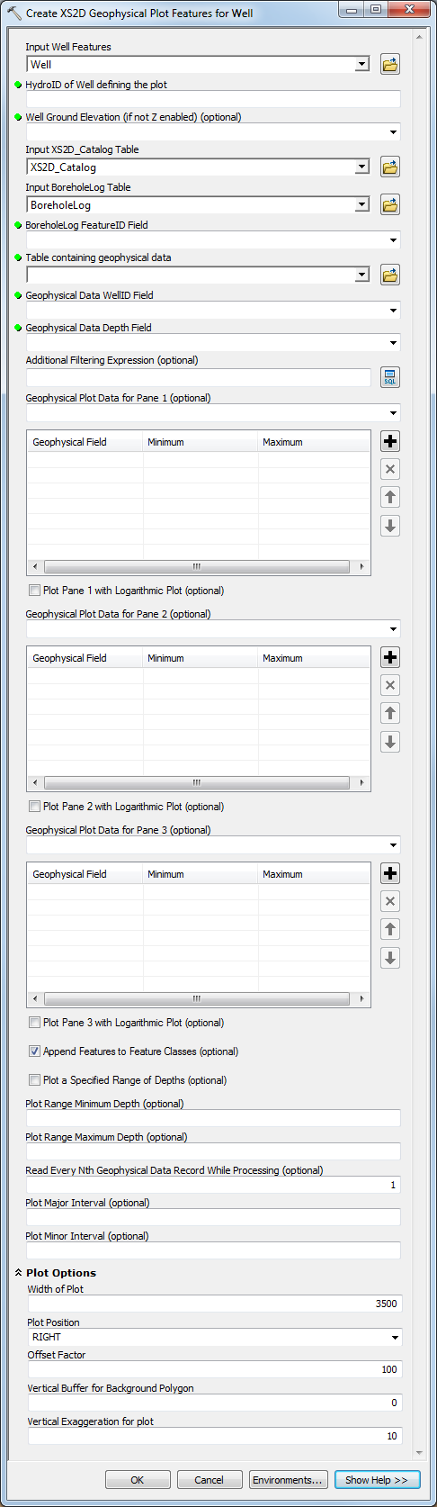
| current | ★ Approved revision 20:01, 29 August 2019 | 486 × 1,674 (84 KB) | Jmonson (talk | contribs) | The ''Create XS2D Geophysical Plot Features for Well'' dialog in Arc Hydro Groundwater. Category:AHGW Dialogs Category:AHGW Subsurface Analyst |
You cannot overwrite this file.
File usage
The following page uses this file: