File:FloodDelineationImpactMap.png
From XMS Wiki
Jump to navigationJump to search
No higher resolution available.
FloodDelineationImpactMap.png (528 × 331 pixels, file size: 19 KB, MIME type: image/png)
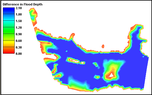
Users can compare two sets of river stages to create an Impact Map, which highlights increases/decreases in flood depths.
File history
Click on a date/time to view the file as it appeared at that time.
| Date/Time | Thumbnail | Dimensions | User | Comment | |
|---|---|---|---|---|---|
| current | ★ Approved revision 16:35, 9 January 2017 | | 528 × 331 (19 KB) | Jcreer (talk | contribs) | |
| 16:54, 21 August 2007 |  | 528 × 331 (17 KB) | Trabadi (talk | contribs) |
You cannot overwrite this file.
File usage
The following page uses this file: