File:FloodPlainDelineation2.png
From XMS Wiki
Jump to navigationJump to search
No higher resolution available.
FloodPlainDelineation2.png (373 × 358 pixels, file size: 155 KB, MIME type: image/png)
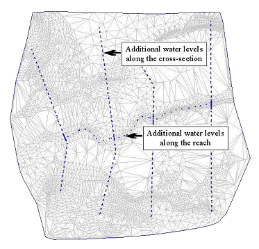
Prepare the water surface elevation data.
File history
Click on a date/time to view the file as it appeared at that time.
| Date/Time | Thumbnail | Dimensions | User | Comment | |
|---|---|---|---|---|---|
| current | ★ Approved revision 14:55, 3 May 2016 | | 373 × 358 (155 KB) | Jcreer (talk | contribs) | |
| 18:01, 27 June 2007 |  | 373 × 358 (54 KB) | Cballard (talk | contribs) |
You cannot overwrite this file.
File usage
The following page uses this file: