File:GIS Raster to Flood Depth.png
From XMS Wiki
Jump to navigationJump to search
No higher resolution available.
GIS_Raster_to_Flood_Depth.png (311 × 228 pixels, file size: 13 KB, MIME type: image/png)
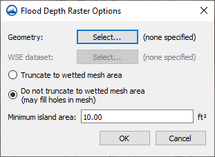
Dialog that appears when Convert to|Flood Depths right-click command is used on an elevation data raster in the Map module.
File history
Click on a date/time to view the file as it appeared at that time.
| Date/Time | Thumbnail | Dimensions | User | Comment | |
|---|---|---|---|---|---|
| current | ★ Approved revision 18:53, 28 February 2022 | | 311 × 228 (13 KB) | Rcorrigan (talk | contribs) |
You cannot overwrite this file.
File usage
The following page uses this file: