File:GSDA TIN Watershed.png
From XMS Wiki
Jump to navigationJump to search
No higher resolution available.
GSDA_TIN_Watershed.png (259 × 230 pixels, file size: 155 KB, MIME type: image/png)
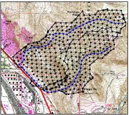
WMS can create a TIN within the watershed boundaries from known elevation points.
File history
Click on a date/time to view the file as it appeared at that time.
| Date/Time | Thumbnail | Dimensions | User | Comment | |
|---|---|---|---|---|---|
| current | ★ Approved revision 19:46, 21 May 2008 | | 259 × 230 (155 KB) | Eshaw (talk | contribs) |
You cannot overwrite this file.
File usage
The following page uses this file: