File:Multiple DEM Basins.png
From XMS Wiki
Jump to navigationJump to search

No higher resolution available.
Multiple_DEM_Basins.png (800 × 276 pixels, file size: 397 KB, MIME type: image/png)
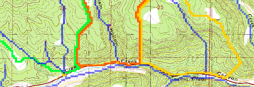
If you leave the outlet of the basin at the bottom node it will create separate basins for the main branch and each branch along the road. In order to combine them into a single basin a small (about one cell in length or less) stub stream is created so that only a single drainage will be used. Remember that WMS will create a separate basin for each upstream branch from an outlet point.
File history
Click on a date/time to view the file as it appeared at that time.
| Date/Time | Thumbnail | Dimensions | User | Comment | |
|---|---|---|---|---|---|
| current | ★ Approved revision 15:51, 9 June 2016 | 800 × 276 (397 KB) | Jcreer (talk | contribs) | ||
| 17:10, 12 June 2007 | 847 × 292 (39 KB) | Cballard (talk | contribs) |
You cannot overwrite this file.
File usage
The following page uses this file: