File:RasterDataExport.png
From XMS Wiki
Jump to navigationJump to search
No higher resolution available.
RasterDataExport.png (336 × 250 pixels, file size: 9 KB, MIME type: image/png)
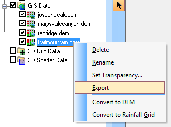
Raster data with information about land use or soil type can be converted to a land use or soil type grid by right-clicking on the layer.
File history
Click on a date/time to view the file as it appeared at that time.
| Date/Time | Thumbnail | Dimensions | User | Comment | |
|---|---|---|---|---|---|
| current | ★ Approved revision 21:51, 18 October 2012 | | 336 × 250 (9 KB) | Cmsmemoe (talk | contribs) |
You cannot overwrite this file.
File usage
The following page uses this file: