File:SMS ZonalClassification3.png
From XMS Wiki
(Redirected from File:SMS ZonalClassification3.jpg)
Jump to navigationJump to search

Size of this preview: 800 × 441 pixels. Other resolution: 1,041 × 574 pixels.
Original file (1,041 × 574 pixels, file size: 79 KB, MIME type: image/png)
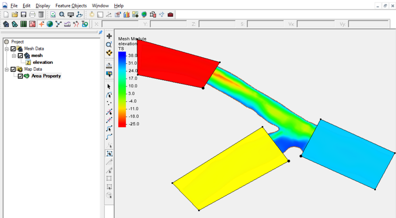
Graphic showing polygons used to designate different substrates in zonal classification.
File history
Click on a date/time to view the file as it appeared at that time.
| Date/Time | Thumbnail | Dimensions | User | Comment | |
|---|---|---|---|---|---|
| current | ★ Approved revision 20:39, 7 April 2023 | | 1,041 × 574 (79 KB) | Jcreer (talk | contribs) | |
| 19:32, 30 April 2015 |  | 959 × 677 (114 KB) | Jcreer (talk | contribs) | ||
| 21:20, 30 November 2007 |  | 640 × 513 (70 KB) | Trabadi (talk | contribs) |
You cannot overwrite this file.
File usage
The following 2 pages use this file:
- File:SMS ZonalClassification3.jpg (file redirect)
- SMS:Zonal Classification