File:WMS DEMexampleQuick.jpg
From XMS Wiki
Jump to navigationJump to search
No higher resolution available.
WMS_DEMexampleQuick.jpg (443 × 459 pixels, file size: 45 KB, MIME type: image/jpeg)
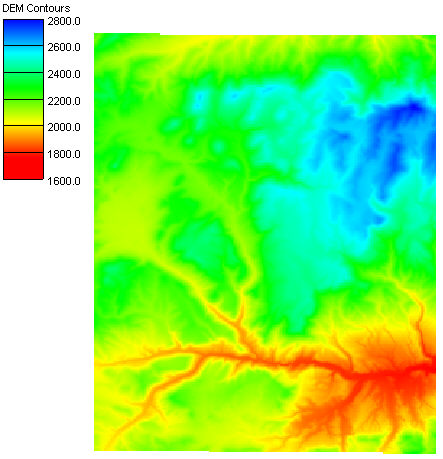
DEM example in WMS
Digital elevation models can be used to quickly delineate watershed boundaries. Gridded elevation datasets can be downloaded from the National Elevation Dataset (NED). This elevation data is available at a resolution of 30-meters for the entire U.S. and some 90-meter world-wide data is also available.
File history
Click on a date/time to view the file as it appeared at that time.
| Date/Time | Thumbnail | Dimensions | User | Comment | |
|---|---|---|---|---|---|
| current | ★ Approved revision 19:16, 7 June 2007 | | 443 × 459 (45 KB) | Cballard (talk | contribs) |
You cannot overwrite this file.
File usage
The following page uses this file: