File:FemaFloodMapImages.png: Difference between revisions
From XMS Wiki
Jump to navigationJump to search
No edit summary |
No edit summary |
||
| Line 2: | Line 2: | ||
WMS 10.0 | WMS 10.0 | ||
Images displaying the FEMA floodplain boundaries and the various floodplain attributes can be downloaded using the web services availabe in WMS | |||
Latest revision as of 15:27, 2 July 2018
WMS 10.0
Images displaying the FEMA floodplain boundaries and the various floodplain attributes can be downloaded using the web services availabe in WMS
File history
Click on a date/time to view the file as it appeared at that time.
| Date/Time | Thumbnail | Dimensions | User | Comment | |
|---|---|---|---|---|---|
| current | ★ Approved revision 17:47, 12 June 2014 | 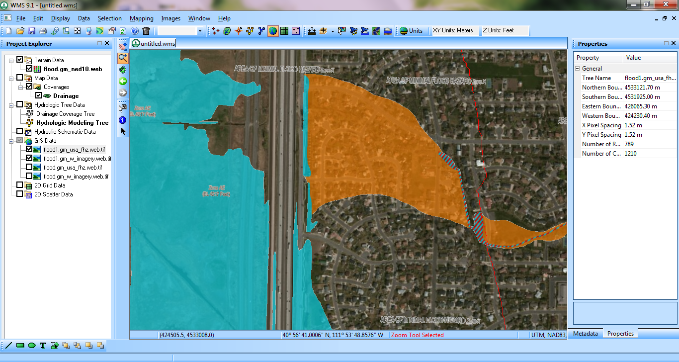 | 1,366 × 728 (1.18 MB) | Cmsmemoe (talk | contribs) |
You cannot overwrite this file.
File usage
The following 2 pages use this file: