WMS:Quick Tour -Storm Drain: Difference between revisions
From XMS Wiki
Jump to navigationJump to search
No edit summary |
No edit summary |
||
| Line 4: | Line 4: | ||
[[Image:StormDrainHydroQuick. | [[Image:StormDrainHydroQuick.png|550 px]] | ||
[[WMS:Quick Tour -HEC-RAS| '''< Previous''']] | [[WMS:Quick Tour - Storm Drain| ''' Next >''']] | [[WMS:Quick Tour -HEC-RAS| '''< Previous''']] | [[WMS:Quick Tour - Storm Drain| ''' Next >''']] | ||
Revision as of 16:46, 5 January 2017
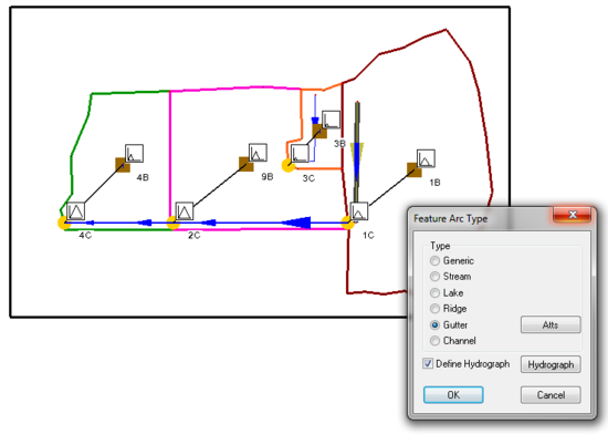
By combining elevation data from a TIN or DEM with feature objects, users can use WMS to expedite the creation of a Storm Drain input file.
Users can use the Rational Method to supply the Storm Drain program with pipe inflows.
