File:DelineateFloodPlainsQuick.jpg: Difference between revisions
From XMS Wiki
Jump to navigationJump to search
m (Jcreer moved page File:Image119.jpg to File:DelineateFloodPlainsQuick.jpg) |
No edit summary |
||
| Line 2: | Line 2: | ||
WMS delineates floodplains by superimposing a set of river stages onto a TIN of ground surface elevations. These river stages can be added to WMS by: | WMS delineates floodplains by superimposing a set of river stages onto a TIN of ground surface elevations. These river stages can be added to WMS by: | ||
*Creating 2D scatter points interactively and assigning them water surface elevations approximated by the Channel Calculator in WMS. | *Creating 2D scatter points interactively and assigning them water surface elevations approximated by the Channel Calculator in WMS. | ||
*Opening a file containing a 2D scatter point set. | *Opening a file containing a 2D scatter point set. | ||
Revision as of 18:59, 3 June 2015
WMS delineates floodplains by superimposing a set of river stages onto a TIN of ground surface elevations. These river stages can be added to WMS by:
- Creating 2D scatter points interactively and assigning them water surface elevations approximated by the Channel Calculator in WMS.
- Opening a file containing a 2D scatter point set.
- Read water surface elevations directly from a solution to a HEC-RAS project file.
File history
Click on a date/time to view the file as it appeared at that time.
| Date/Time | Thumbnail | Dimensions | User | Comment | |
|---|---|---|---|---|---|
| current | ★ Approved revision 16:48, 21 August 2007 | 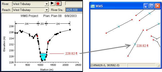 | 647 × 289 (36 KB) | Trabadi (talk | contribs) |
You cannot overwrite this file.
File usage
The following page uses this file: