File:JoinSsurgoData.png: Difference between revisions
From XMS Wiki
Jump to navigationJump to search
No edit summary |
No edit summary |
||
| Line 2: | Line 2: | ||
[[Category:SSURGO]] | [[Category:SSURGO]] | ||
[[Category:WMS GIS]] | [[Category:WMS GIS]] | ||
This figure shows the different values extracted from the SSURGO soil that are mapped in the WMS soil coverage. | |||
Latest revision as of 15:27, 31 May 2018
This figure shows the different values extracted from the SSURGO soil that are mapped in the WMS soil coverage.
File history
Click on a date/time to view the file as it appeared at that time.
| Date/Time | Thumbnail | Dimensions | User | Comment | |
|---|---|---|---|---|---|
| current | ★ Approved revision 16:37, 22 September 2009 | 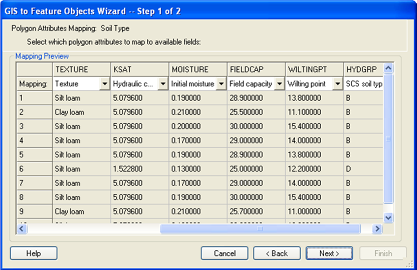 | 849 × 550 (229 KB) | Cmsmemoe (talk | contribs) |
You cannot overwrite this file.
File usage
The following page uses this file: