File:OverlandFlowBcStormSurge.png
From XMS Wiki
Jump to navigationJump to search
Size of this preview: 800 × 289 pixels. Other resolution: 867 × 313 pixels.
Original file (867 × 313 pixels, file size: 376 KB, MIME type: image/png)
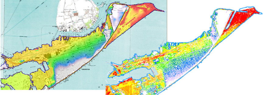
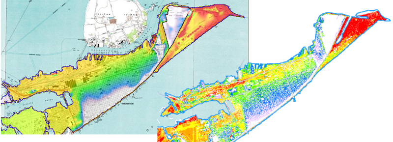
Coastal storm surge simulation in Galveston Island Texas. The figure on the left shows GSSHA inundation depths using overland boundary conditions. The figure on the right is an inundation map for the same event produced by NOAA.
File history
Click on a date/time to view the file as it appeared at that time.
| Date/Time | Thumbnail | Dimensions | User | Comment | |
|---|---|---|---|---|---|
| current | ★ Approved revision 16:36, 22 September 2009 | 867 × 313 (376 KB) | Cmsmemoe (talk | contribs) |
You cannot overwrite this file.
File usage
The following page uses this file: