File:ProbalisticFloodplanInundation.jpg: Difference between revisions
From XMS Wiki
Jump to navigationJump to search
No edit summary |
m (Jcreer moved page File:Image136.jpg to File:ProbalisticFloodplanInundation.jpg) |
(No difference)
| |
Revision as of 16:17, 20 May 2015
Close Up
A final dataset showing the probability of flooding is also created from all of the individual floodplain datasets. The probabilistic flood plain indicates for each vertex on the TIN the percentage of model runs that resulting in inundation at the point.
File history
Click on a date/time to view the file as it appeared at that time.
| Date/Time | Thumbnail | Dimensions | User | Comment | |
|---|---|---|---|---|---|
| current | ★ Approved revision 21:18, 9 July 2007 | 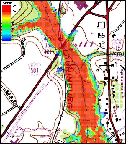 | 427 × 487 (115 KB) | Eshaw (talk | contribs) |
You cannot overwrite this file.
File usage
The following page uses this file: