File:RationalStormDrainQuick.png: Difference between revisions
From XMS Wiki
Jump to navigationJump to search
No edit summary |
No edit summary |
||
| Line 1: | Line 1: | ||
[[Category:WMS Quick Tour]] | [[Category:WMS Quick Tour]] | ||
By combining elevation data from a TIN or DEM with feature objects, users can use WMS to expedite the creation of a Storm Drain input file. | |||
Revision as of 15:42, 23 September 2014
By combining elevation data from a TIN or DEM with feature objects, users can use WMS to expedite the creation of a Storm Drain input file.
File history
Click on a date/time to view the file as it appeared at that time.
| Date/Time | Thumbnail | Dimensions | User | Comment | |
|---|---|---|---|---|---|
| current | ★ Approved revision 16:32, 15 November 2016 | 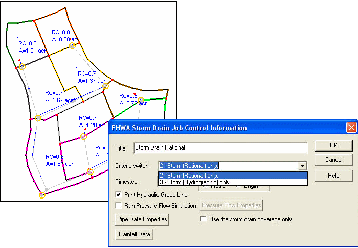 | 700 × 486 (79 KB) | Jcreer (talk | contribs) | |
| 16:32, 21 August 2007 | 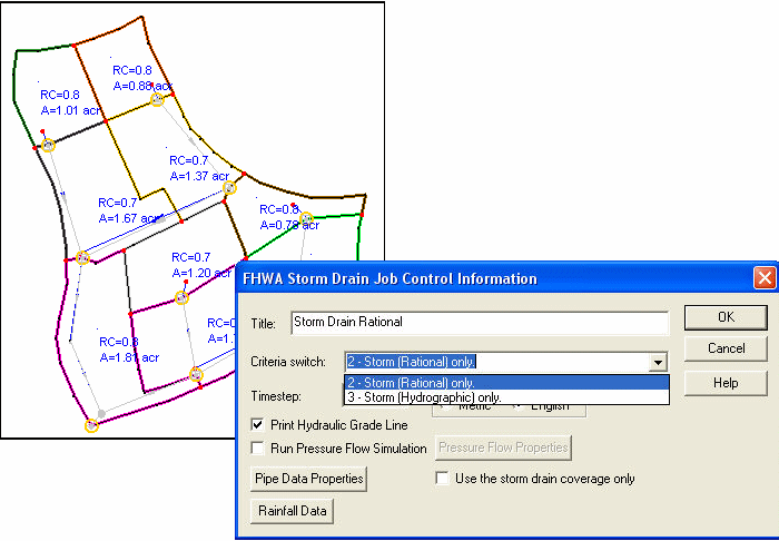 | 700 × 486 (36 KB) | Trabadi (talk | contribs) |
You cannot overwrite this file.
File usage
The following page uses this file: