File:SMPDBK2.png
From XMS Wiki
Jump to navigationJump to search
No higher resolution available.
SMPDBK2.png (383 × 333 pixels, file size: 119 KB, MIME type: image/png)
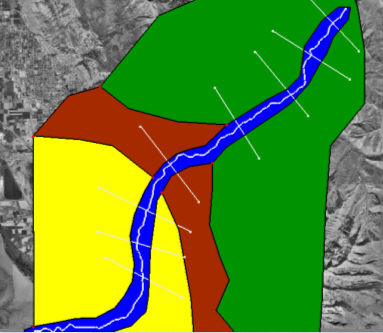
An Area Property Coverage that consists of polygons corresponding to the different land use (roughness) types found in the floodplain.
File history
Click on a date/time to view the file as it appeared at that time.
| Date/Time | Thumbnail | Dimensions | User | Comment | |
|---|---|---|---|---|---|
| current | ★ Approved revision 14:58, 5 June 2008 | | 383 × 333 (119 KB) | Eshaw (talk | contribs) |
You cannot overwrite this file.
File usage
The following page uses this file: