File:Tin1.jpg: Difference between revisions
From XMS Wiki
Jump to navigationJump to search
No edit summary |
No edit summary |
||
| (One intermediate revision by the same user not shown) | |||
| Line 1: | Line 1: | ||
[[Category:WMS Quick Tour]] | [[Category:WMS Quick Tour]] | ||
[[Category:TINs]] | |||
Triangulated Irregular Networks (TINs) can also be used to delineate watersheds and set up hydrologic models. The first step in the process is to obtain elevation data. Elevations can come from DEM files, digitized data, or any other scattered xyz data source. | |||
Latest revision as of 15:55, 6 January 2017
Triangulated Irregular Networks (TINs) can also be used to delineate watersheds and set up hydrologic models. The first step in the process is to obtain elevation data. Elevations can come from DEM files, digitized data, or any other scattered xyz data source.
File history
Click on a date/time to view the file as it appeared at that time.
| Date/Time | Thumbnail | Dimensions | User | Comment | |
|---|---|---|---|---|---|
| current | ★ Approved revision 19:30, 7 June 2007 | 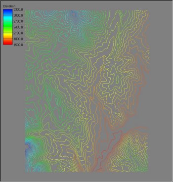 | 350 × 368 (26 KB) | Cballard (talk | contribs) |
You cannot overwrite this file.
File usage
The following page uses this file: