Search results
From XMS Wiki
Jump to navigationJump to search
Page title matches
- {{SMS at a glance raster module|Heading===At a glance==}} ...odule. All previous functionality is available on raster entities in that module.4 KB (628 words) - 19:11, 16 April 2021
- 25 bytes (3 words) - 17:07, 4 May 2017

File:Raster Module icon.png [[Category:Module Icons]](15 × 15 (660 bytes)) - 22:41, 15 June 2017- ...item [[File:Raster Folder.svg|16 px]] in the Project Explorer. The raster module interface consists of the menu, tools, and Project Explorer right-click men ..., the module interface has been incorporated into the [[SMS:GIS Module|GIS module]].4 KB (587 words) - 16:12, 12 June 2018
- [[File:Raster4.png|thumb|500px|right|Raster module example]] '''NOTE''': the functionality of this module was incorporated into the GIS module starting with SMS version 12.0782 bytes (114 words) - 14:31, 20 September 2017
Page text matches
- ! width="175" style="background: #ddf"|<small>Raster Pages</small> * <small>[[SMS:Raster Module|Raster Module]]449 bytes (56 words) - 20:37, 19 March 2014
- [[File:Raster4.png|thumb|500px|right|Raster module example]] '''NOTE''': the functionality of this module was incorporated into the GIS module starting with SMS version 12.0782 bytes (114 words) - 14:31, 20 September 2017
- :Raster data is imported into the [[WMS:GIS Module|GIS module]] in WMS. :#Use the [[WMS:File Menu|'''Open''']] command to import raster data files such as DEMs, [[KMZ files]], and gridded elevation formats.333 bytes (52 words) - 20:45, 19 November 2019
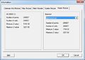
File:SMS Info Raster.jpg [[Category:SMS Raster Dialogs]] [[Category:Raster]](552 × 393 (32 KB)) - 16:02, 10 December 2015- :Raster data is imported into the [[SMS:GIS Module|GIS module]] in SMS. :#Use the [[SMS:File Menu|'''Open''']] command to import raster data files such as DEMs, [[KMZ files]], and gridded elevation formats.340 bytes (53 words) - 20:45, 19 November 2019
- Files and articles related to dialogs in the Raster module [[Category:SMS Dialogs|Raster]]15 members (0 subcategories, 11 files) - 15:23, 8 December 2015
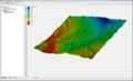
File:Raster4.png [[Category:Raster]] Raster Module Example(800 × 486 (172 KB)) - 16:55, 27 July 2017- * [[Flood Depth Raster Tool]] ;1. 1D River Module2 KB (211 words) - 19:59, 8 February 2023
- Icons used in the Raster module. [[Category:Raster]]22 members (0 subcategories, 22 files) - 14:48, 10 May 2017
- #REDIRECT [[SMS:Raster Module Interface]]41 bytes (5 words) - 17:27, 6 June 2013
- #REDIRECT [[SMS:Raster Module Interface]]41 bytes (5 words) - 17:27, 6 June 2013
- #REDIRECT [[SMS:Raster Module Interface]]41 bytes (5 words) - 17:28, 6 June 2013
- #REDIRECT [[SMS:Raster Module Interface]]41 bytes (5 words) - 17:34, 6 June 2013
- ..., [[Lidar Support|Lidar]], DEM, [[SMS:XYZ Files|XYZ]], [[SMS:Raster Module|Raster]], etc.). :# [[SMS:GIS Module|GIS data]] (Land Use, etc.).2 KB (213 words) - 14:43, 21 July 2017
- ..., [[Lidar Support|Lidar]], DEM, [[SMS:XYZ Files|XYZ]], [[SMS:Raster Module|Raster]], etc.). :# [[SMS:GIS Module|GIS data]] (Land Use, etc.).495 bytes (67 words) - 17:57, 15 February 2017
- There are several kinds of vector files and many kinds of raster files that are automatically identified and read into SMS. *ESRI Shapefiles – read into GIS module1 KB (218 words) - 21:39, 5 September 2018
- !style="text-align:left;"|1. Interpolate raster data to active coverage. :# Select and make active the [[WMS:Coverages|map coverage]] where the raster data is to be interpolated.1 KB (187 words) - 23:29, 19 November 2019

File:WMSGISRasterImageTreeIcon.png [[Category:Module Icons]] [[Category:Raster Icons]](16 × 18 (625 bytes)) - 16:04, 2 March 2017- ...item [[File:Raster Folder.svg|16 px]] in the Project Explorer. The raster module interface consists of the menu, tools, and Project Explorer right-click men ..., the module interface has been incorporated into the [[SMS:GIS Module|GIS module]].4 KB (587 words) - 16:12, 12 June 2018
- * Open and visualize raster data * GIS data can be converted to feature data (map module)522 bytes (83 words) - 16:41, 10 October 2017


