Template:SMS at a glance raster module: Difference between revisions
From XMS Wiki
Jump to navigationJump to search
No edit summary |
No edit summary |
||
| (5 intermediate revisions by the same user not shown) | |||
| Line 1: | Line 1: | ||
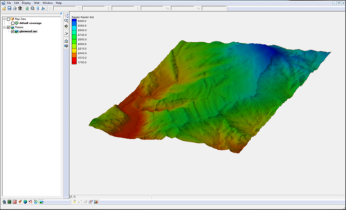
[[File:Raster4.png|thumb|500px|right|Raster | [[File:Raster4.png|thumb|500px|right|Raster module example]] | ||
{{{Heading}}} | {{{Heading}}} | ||
'''NOTE''': the functionality of this module was incorporated into the GIS module starting with SMS version 12.0 | '''NOTE''': the functionality of this module was incorporated into the GIS module starting with SMS version 12.0 | ||
* Open and visualize raster data | * Open and visualize raster data | ||
* Supports many gridded elevation file formats. A complete list can be found at: [http://www.globalmapper.com/product/formats.htm www.globalmapper.com/product/formats.htm] | * Supports many gridded elevation file formats. A complete list can be found at: [http://www.globalmapper.com/product/formats.htm www.globalmapper.com/product/formats.htm] | ||
* One or more rasters are placed under a raster set in the | * One or more rasters are placed under a raster set in the Project Explorer. | ||
* Convert raster to TIN (scatter set) | * Convert raster to TIN (scatter set) | ||
* Interpolate data from raster to TINs /2D | * Interpolate data from raster to TINs /2D mesh/2D grid | ||
* Use rasters with observation profile plots | * Use rasters with observation profile plots | ||
{{{Link|}}} | {{{Link|}}} | ||
<br style="clear:both;"/><noinclude>[[Category:SMS at a glance]] [[Category:External Links]][[Category: | <br style="clear:both;"/><noinclude>[[Category:SMS at a glance|raster]] [[Category:External Links]][[Category:Raster]] [[Category:Archived|raster]]</noinclude> | ||
Latest revision as of 14:31, 20 September 2017
{{{Heading}}} NOTE: the functionality of this module was incorporated into the GIS module starting with SMS version 12.0
- Open and visualize raster data
- Supports many gridded elevation file formats. A complete list can be found at: www.globalmapper.com/product/formats.htm
- One or more rasters are placed under a raster set in the Project Explorer.
- Convert raster to TIN (scatter set)
- Interpolate data from raster to TINs /2D mesh/2D grid
- Use rasters with observation profile plots
