Search results
From XMS Wiki
Jump to navigationJump to search
- {{SMS at a glance raster module|Heading===At a glance==}} ...odule. All previous functionality is available on raster entities in that module.4 KB (628 words) - 19:11, 16 April 2021
- ...priate "Raster Set". Data will be plotted from the rasters in the selected raster set. ...and 2D grids. To interpolate the values from a raster, right-click on the raster set in the ''project explorer'' and choose '''Interpolate'''. Then choose t2 KB (356 words) - 19:57, 24 August 2017
- |group2 = [[SMS:SMS Menus#Module_Specific_Menus|'''Module Menus:''']] ...ree Menus|Quadtree]] {{·}} [[SMS:Raster Module Interface#Raster Menu Items|Raster]] {{·}} [[SMS:Scatter_Module#Scatter_Module_Menus|Scatter]]2 KB (216 words) - 21:07, 22 July 2020
- !style="text-align:left;"|1. Interpolate raster data to active coverage. :# Select and make active the [[GMS:Coverages|map coverage]] where the raster data is to be interpolated.4 KB (554 words) - 18:55, 10 March 2017
- ...nfo MID/MIF|MIF/MID files]], [[Lidar|Lidar files]], or [[SMS:Raster Module|raster files]].398 bytes (61 words) - 16:14, 7 November 2019
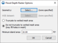
File:GIS Raster to Flood Depth.png ...pths''' right-click command is used on an elevation data raster in the Map module.(311 × 228 (13 KB)) - 18:59, 28 February 2022- ...be found by clicking on the [[File:GMS Properties Macro.svg|16 px]] '''Get Module Info''' macro or using the '''Get Info''' command in the ''File'' menu. ...orts basic information concerning the data type associated with the active module. Information is available for the following modules:4 KB (524 words) - 16:47, 19 September 2019
- To work with [[WMS:GIS Module|GIS]] data into WMS, use the following steps: ==Using the GIS module in WMS==1 KB (212 words) - 20:22, 21 April 2023
- !style="text-align:left;"|1. Interpolate raster data to active coverage. :# Select and make active the [[SMS:Coverages|map coverage]] where the raster data is to be interpolated.2 KB (258 words) - 15:27, 23 September 2015
- ...he Project Explorer and select the [[WMS:Project Explorer Contents for GIS Module|'''Transparency''']] command. ! style="text-align:left;"|2. Smooth a raster image.3 KB (425 words) - 23:25, 18 November 2019
- This category contains articles related to the Raster Module.44 members (3 subcategories, 24 files) - 17:24, 26 March 2015
- ...ext-align:left;"|1. [[GIS Conversion and Editing#Trimmed Raster|Trim]] the raster. :#Select a coverage (or create a new coverage) in the [[GMS:Map Module|Map]] module.2 KB (292 words) - 15:20, 6 June 2017
- !style="text-align:left;"|1. Convert raster data to feature contours. ...on the raster image and select the [[WMS:Project Explorer Contents for GIS Module|''Convert To'' | '''Feature Contours''']] command to create a new map cover2 KB (346 words) - 23:35, 18 November 2019
- To work with [[SMS:GIS Module|GIS]] data into SMS, use the following steps: ==Using the GIS module in SMS==2 KB (314 words) - 18:52, 28 March 2019
- :DEMS imported into the [[WMS:Terrain Data Module|Terrain Data module]] in WMS. :#Use the [[WMS:File Menu|'''Open''']] command to import raster data files such as DEMs, [[KMZ files]], and gridded elevation formats.1 KB (195 words) - 20:58, 9 December 2019
- ...ster Module|Raster]]{{·}} [[SMS:Scatter_Module|Scatter]] {{·}} [[SMS:UGrid Module|UGrid]]2 KB (215 words) - 20:36, 11 September 2023
- ! style="text-align:left;"|2. Smooth a raster image. ..._Module_Menus#GIS_Module_Right-Click_Commands|''Convert To'' | '''Smoothed Raster''']] command.3 KB (446 words) - 16:42, 8 November 2019
- |above = {{noprint|[[GMS:GIS Module|GIS Module]]}} |data13 = {{noprint|[[GMS:Raster Catalog|Raster Catalogs]]}}1 KB (141 words) - 15:04, 25 August 2017
- ...ment mesh) is preserved when switching to a different module. Activating a module only changes the [[SMS:Dynamic Tools|Dynamic Toolbar]] and available menu c {{SMS Module Selection|Heading===Module Selection==}}2 KB (300 words) - 18:06, 5 May 2022
- ...con.svg|16 px]] item in the Project Explorer. Once active, the ''Scatter'' module tool bar menu will appear to the right of the Project Explorer. ==Scatter Module Right-Click Menus==4 KB (547 words) - 20:57, 21 March 2022
