File:FeatureContoursGivenElevation.jpg: Difference between revisions
From XMS Wiki
Jump to navigationJump to search
No edit summary |
No edit summary |
||
| (6 intermediate revisions by the same user not shown) | |||
| Line 1: | Line 1: | ||
Example of feature contours generated using a given elevation. | Example of feature contours generated using a given elevation. | ||
[[Category:GIS]] | |||
[[Category:Raster]] | |||
[[Category:SMS GIS]] | |||
Latest revision as of 17:13, 30 August 2017
Example of feature contours generated using a given elevation.
File history
Click on a date/time to view the file as it appeared at that time.
| Date/Time | Thumbnail | Dimensions | User | Comment | |
|---|---|---|---|---|---|
| current | ★ Approved revision 17:12, 30 August 2017 | 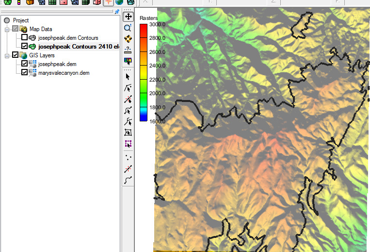 | 763 × 519 (148 KB) | Jcreer (talk | contribs) | |
| 17:42, 24 March 2015 |  | 895 × 757 (269 KB) | Jcreer (talk | contribs) |
You cannot overwrite this file.
File usage
The following 3 pages use this file: