File:Tin3.jpg: Difference between revisions
From XMS Wiki
Jump to navigationJump to search
No edit summary |
No edit summary |
||
| (4 intermediate revisions by the same user not shown) | |||
| Line 1: | Line 1: | ||
[[Category:WMS Quick Tour]] | [[Category:WMS Quick Tour]] | ||
[[Category:TINs]] | |||
[[Category:WMS Basins]] | |||
[[Category:WMS Map]] | |||
By using GIS Vector data to establish streams and a "rough" boundary, a TIN well-suited for basin delineation can be created. | |||
Latest revision as of 16:27, 9 January 2017
By using GIS Vector data to establish streams and a "rough" boundary, a TIN well-suited for basin delineation can be created.
File history
Click on a date/time to view the file as it appeared at that time.
| Date/Time | Thumbnail | Dimensions | User | Comment | |
|---|---|---|---|---|---|
| current | ★ Approved revision 19:32, 7 June 2007 | 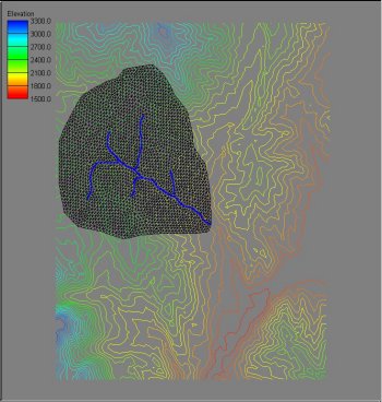 | 350 × 368 (31 KB) | Cballard (talk | contribs) |
You cannot overwrite this file.
File usage
The following 2 pages use this file: