Search results
From XMS Wiki
Jump to navigationJump to search
Page title matches
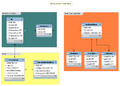
- [[Image:HGS_data_model.png|thumb|250px|<div>HydroGeoSphere Data Model<br>Created using MySQL Workbench</div>]] ...drogw.com/ahgw/Arc_Hydro_Groundwater_Data_Model Arc Hydro Groundwater Data Model].9 KB (1,398 words) - 17:25, 7 October 2016
Page text matches
File:HGS data model.png HydroGeoSphere Data Model(807 × 580 (43 KB)) - 14:41, 5 June 2018- ...g on a coverage in the Project Explorer and selecting ''Coverage Type''→'''HydroGeoSphere''', and then selecting the desired coverage from the right-click menu. ...then selecting the desired simulation. Coverages that are not applied to a HydroGeoSphere simulation will not have the properties in the coverage included in the sim2 KB (357 words) - 20:31, 3 May 2024
- ...g on a coverage in the Project Explorer and selecting ''Coverage Type''→'''HydroGeoSphere''', and then selecting the desired coverage from the right-click menu. ...then selecting the desired simulation. Coverages that are not applied to a HydroGeoSphere simulation will not have the properties in the coverage included in the sim2 KB (330 words) - 19:29, 26 September 2023
- ...f the specific workflows needed in creating a general [[GMS:HydroGeoSphere|HydroGeoSphere]] project. Newer and infrequent GMS users should start here. To build a [[GMS:HydroGeoSphere|HydroGeoSphere]] model in GMS, use the following steps:3 KB (385 words) - 22:20, 26 February 2024
- ...imulator created by [https://www.aquanty.com/ Aquanty]. HGS can be used to model the entire terrestrial portion of the hydrologic cycle. It uses a globally- ==HydroGeoSphere Simulations==4 KB (625 words) - 19:19, 30 April 2024
- *[[User:Mkennard/HydroGeoSphere Data Model/Temp]] *[[GMS:HydroGeoSphere|HydroGeoSphere]]3 KB (351 words) - 15:35, 23 February 2024
- The ''Point Properties'' dialog in the HydroGeoSphere model is where the input parameters for nodes associated with the relative covera ...dition for a point on the boundary conditions coverage of a HydroGeoSphere model. The input options for a flux nodal designation are listed below.4 KB (637 words) - 15:04, 2 May 2024
- The ''Point Properties'' dialog in the HydroGeoSphere model is where the input parameters for nodes associated with the relative covera ...dition for a point on the boundary conditions coverage of a HydroGeoSphere model. The input options for a flux nodal designation are listed below.4 KB (631 words) - 18:00, 26 September 2023
- The ''Polygon Properties'' dialog in the HydroGeoSphere model is where a polygon or polygons can be assigned a boundary condition. There *** ''Input type'' – How the boundary condition data is specified.4 KB (649 words) - 15:26, 2 May 2024
- ...boundary conditions or hydrograph coverage are defined in a HydroGeoSphere model. Only one type of boundary condition can be assigned to a feature object on *** ''Input type'' – How the boundary condition data is specified.6 KB (871 words) - 15:03, 2 May 2024
- ...boundary conditions or hydrograph coverage are defined in a HydroGeoSphere model. Only one type of boundary condition can be assigned to a feature object on *** ''Input type'' – How the boundary condition data is specified.6 KB (854 words) - 20:56, 26 September 2023
- ...be left as is, or it can be changed in the ''Simulation Control'' dialog. Data input options include, but are not limited to: time stepping, output, zones [[File:HGS sim control.png|thumb|500 px|HydroGeoSphere ''Simulation Control'' dialog]]10 KB (1,493 words) - 21:59, 30 April 2024
- ...be left as is, or it can be changed in the ''Simulation Control'' dialog. Data input options include, but are not limited to: time stepping, output, zones [[File:HGS sim control.png|thumb|500 px|HydroGeoSphere ''Simulation Control'' dialog]]10 KB (1,454 words) - 17:58, 26 September 2023
- The ''Polygon Properties'' dialog in the HydroGeoSphere model is where a polygon or polygons can be assigned a boundary condition. There *** ''Input type'' – How the boundary condition data is specified.4 KB (637 words) - 19:31, 26 September 2023
- [[Image:HGS_data_model.png|thumb|250px|<div>HydroGeoSphere Data Model<br>Created using MySQL Workbench</div>]] ...drogw.com/ahgw/Arc_Hydro_Groundwater_Data_Model Arc Hydro Groundwater Data Model].9 KB (1,398 words) - 17:25, 7 October 2016
- :[[Data Calculator|Data Calculator]] :[[GMS:Converting TINS to Other Data Types|Converting TINS to Other Data Types]]22 KB (3,073 words) - 19:37, 3 May 2024
- # [[GMS:Conceptual Model#Conceptual Model Properties|Conceptual Model Properties]] | 402 | IDD_CONMOD_PROP # [[Data Calculator|Data Calculator]] | 471 | IDD_DATA_CALCULATOR31 KB (4,278 words) - 20:34, 8 March 2024
- # [[GMS:Conceptual Model#Conceptual Model Properties|Conceptual Model Properties]] | 402 | IDD_CONMOD_PROP # [[Data Calculator|Data Calculator]] | 471 | IDD_DATA_CALCULATOR32 KB (4,300 words) - 20:29, 8 March 2024
- !''Conceptual Model Approach'' !''Conceptual Model Approach I''318 KB (33,456 words) - 22:34, 3 January 2024
- ...ttps://www.aquaveo.com/blog/2024/04/30/moving-data-other-geometries Moving Data to Other Geometries] ...2024/02/13/generating-3d-grid-raster-data Generating a 3D Grid from Raster Data]58 KB (6,637 words) - 20:07, 7 May 2024
