WMS:Quick Tour -Floodplain Delineation
From XMS Wiki
Jump to navigationJump to search
WMS delineates floodplains by superimposing a set of river stages onto a TIN of ground surface elevations. These river stages can be added to WMS by:
- Creating 2D scatter points interactively and assigning them water surface elevations approximated by the Channel Calculator in WMS.
- Opening a file containing a 2D scatter point set.
ID X Y wse_plan1 wse_plan2 0 1213.23 388.83 6.38 8.22 1 1219.58 387.29 6.02 7.97 2 1225.81 385.47 5.86 7.82
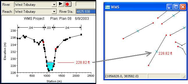
- Read water surface elevations directly from a solution to a HEC-RAS project file.

