WMS:Quick Tour - Watershed Outlet: Difference between revisions
From XMS Wiki
Jump to navigationJump to search
No edit summary |
No edit summary |
||
| (2 intermediate revisions by the same user not shown) | |||
| Line 1: | Line 1: | ||
[[Image:wmsquicktour.jpg]] | [[Image:wmsquicktour.jpg]] | ||
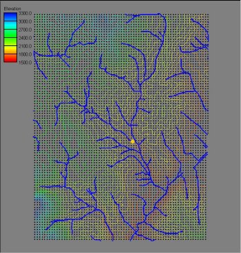
In order to delineate the watershed boundary an outlet location needs to be identified. Typically | In order to delineate the watershed boundary an outlet location needs to be identified. Typically, most users will want to create the outlet points in one of the "flow accumulation" cells (where there is a lot of contributing area upstream). | ||
[[Image:dem3b.jpg]] | [[Image:dem3b.jpg]] | ||
| Line 7: | Line 7: | ||
[[WMS:Quick Tour - Flow Accumulation| '''< Previous''']] | [[WMS:Quick Tour - Basin Delineation| ''' Next >''']] | [[WMS:Quick Tour - Flow Accumulation| '''< Previous''']] | [[WMS:Quick Tour - Basin Delineation| ''' Next >''']] | ||
{{WMSQuick}} | |||
[[Category:WMS Quick Tour|W]] | |||
Latest revision as of 15:49, 11 April 2017
In order to delineate the watershed boundary an outlet location needs to be identified. Typically, most users will want to create the outlet points in one of the "flow accumulation" cells (where there is a lot of contributing area upstream).


