WMS:Quick Tour - Adding GIS Data without ArcObjects: Difference between revisions
From XMS Wiki
Jump to navigationJump to search
No edit summary |
No edit summary |
||
| (4 intermediate revisions by the same user not shown) | |||
| Line 3: | Line 3: | ||
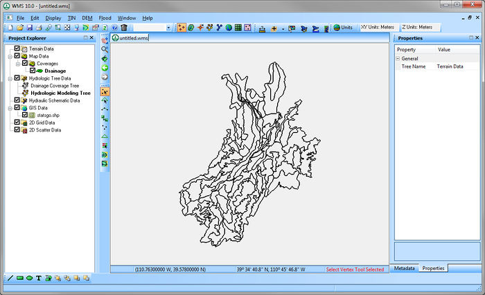
For individuals who prefer not to use ArcObjects, or do not have access to an ArcGIS license, WMS provides a second method for opening GIS data. This method requires that the data be in shapefile format before it can be added to WMS. The entire shapefile, or a subset of shapes, can then be converted to feature objects. | For individuals who prefer not to use ArcObjects, or do not have access to an ArcGIS license, WMS provides a second method for opening GIS data. This method requires that the data be in shapefile format before it can be added to WMS. The entire shapefile, or a subset of shapes, can then be converted to feature objects. | ||
[[Image: | [[Image:GISshapefileExample.jpg|700 px]] | ||
[[WMS:Quick Tour - Adding GIS Data with ArcObjects| '''< Previous''']] | [[WMS:Quick Tour - Join Tables| ''' Next >''']] | [[WMS:Quick Tour - Adding GIS Data with ArcObjects| '''< Previous''']] | [[WMS:Quick Tour - Join Tables| ''' Next >''']] | ||
{{WMSQuick}} | |||
[[Category:WMS Quick Tour|A]] | |||
[[Category:WMS GIS]] | |||
Latest revision as of 15:52, 11 April 2017
For individuals who prefer not to use ArcObjects, or do not have access to an ArcGIS license, WMS provides a second method for opening GIS data. This method requires that the data be in shapefile format before it can be added to WMS. The entire shapefile, or a subset of shapes, can then be converted to feature objects.


