AHGW:Introduction: Difference between revisions
m (Move page script moved page AHGW:Introduction to Test:Introduction without leaving a redirect) |
No edit summary |
||
| (4 intermediate revisions by 2 users not shown) | |||
| Line 1: | Line 1: | ||
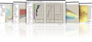
[[AHGW:AHGW|Arc Hydro Groundwater]] (AHGW) is a geodatabase toolbox for representing groundwater datasets within [[ArcGIS]]. The [[AHGW:Arc Hydro Groundwater Data Model|data model]] helps archive, display, and analyze multidimensional groundwater data, and includes several components to represent different types of datasets. These include representations of aquifers and wells/boreholes, 3D hydrogeologic models, temporal information, and data from simulation models. | [[Image:AHGW-image-library.png|380px|right|alt=|link=AHGW:Image Gallery]] | ||
[[AHGW:AHGW|Arc Hydro Groundwater Pro]] (AHGW Pro) is a geodatabase toolbox for representing groundwater datasets within [[ArcGIS]] Pro. The [[AHGW:Arc Hydro Groundwater Data Model|data model]] helps archive, display, and analyze multidimensional groundwater data, and includes several components to represent different types of datasets. These include representations of aquifers and wells/boreholes, 3D hydrogeologic models, temporal information, and data from simulation models. | |||
AHGW for ArcGIS Pro has two main applications: groundwater analyst and subsurface analyst. | |||
AHGW is also available for older versions of ArcGIS. AHGW for ArcGIS has three main applications: groundwater analyst, MODFLOW analyst, and subsurface analyst. | |||
The Arc Hydro Groundwater Tools were developed by [http://www.aquaveo.com Aquaveo] in partnership with [http://www.esri.com ESRI]. | The Arc Hydro Groundwater Tools were developed by [http://www.aquaveo.com Aquaveo] in partnership with [http://www.esri.com ESRI]. | ||
Latest revision as of 20:13, 13 April 2023
Arc Hydro Groundwater Pro (AHGW Pro) is a geodatabase toolbox for representing groundwater datasets within ArcGIS Pro. The data model helps archive, display, and analyze multidimensional groundwater data, and includes several components to represent different types of datasets. These include representations of aquifers and wells/boreholes, 3D hydrogeologic models, temporal information, and data from simulation models.
AHGW for ArcGIS Pro has two main applications: groundwater analyst and subsurface analyst.
AHGW is also available for older versions of ArcGIS. AHGW for ArcGIS has three main applications: groundwater analyst, MODFLOW analyst, and subsurface analyst.
The Arc Hydro Groundwater Tools were developed by Aquaveo in partnership with ESRI.
External Links