Category:Noindexed pages: Difference between revisions
From XMS Wiki
Jump to navigationJump to search
(create cat) |
(format) |
||
| Line 1: | Line 1: | ||
Pages tagged with | Pages tagged with {{tl|noindex}}. | ||
[[Category:Hidden categories]] | [[Category:Hidden categories]] | ||
Latest revision as of 19:32, 28 December 2015
Pages tagged with {{noindex}}
.
Pages in category "Noindexed pages"
The following 142 pages are in this category, out of 585 total.
(previous page) (next page)R
- User:Rcorrigan/AHGW Pro:Polygon to TIN
- User:Rcorrigan/AHGW Pro:Rasters to GeoSections
- User:Rcorrigan/AHGW Pro:Rasters to GeoVolumes
- User:Rcorrigan/AHGW Pro:Registering AHGW
- User:Rcorrigan/AHGW Pro:Reverse Section Line Orientation
- User:Rcorrigan/AHGW Pro:Scale XS2D Features
- User:Rcorrigan/AHGW Pro:Set Up
- User:Rcorrigan/AHGW Pro:Subsurface Analyst 3D Import
- User:Rcorrigan/AHGW Pro:Time Series Grapher
- User:Rcorrigan/AHGW Pro:Transform Faults to XS2D Lines
- User:Rcorrigan/AHGW Pro:Transform GeoSection to XS2D Panel
- User:Rcorrigan/AHGW Pro:Transform Lines to XS2D Points
- User:Rcorrigan/AHGW Pro:Transform Points to XS2D Points
- User:Rcorrigan/AHGW Pro:Transform Polygons to XS2D Lines
- User:Rcorrigan/AHGW Pro:Transform Raster to XS2D Line
- User:Rcorrigan/AHGW Pro:Transform XS2D Lines to Points
- User:Rcorrigan/AHGW Pro:Transform XS2D Panel to GeoSection
- User:Rcorrigan/AHGW Pro:Transform XS2D Well Detail Line
- User:Rcorrigan/AHGW Pro:Transform XS2D Well Detail Polygon
- User:Rcorrigan/AHGW Pro:Troubleshooting 3D Bore Lines
- User:Rcorrigan/AHGW Pro:Tutorials
- User:Rcorrigan/AHGW Pro:XS2D Cross Section Image
- User:Rcorrigan/AHGW:Add to Raster Series Pro
- User:Rcorrigan/AHGW:Assign HydroID GW Pro
- User:Rcorrigan/AHGW:Create AHGW Raster Catalog Pro
- User:Rcorrigan/AHGW:Create Blank AHGW Geodatabase Pro
- User:Rcorrigan/AHGW:Create Unique ID Table Pro
- User:Rcorrigan/AHGW:Groundwater Analyst
- User:Rcorrigan/AHGW:Make Time Series Statistics Pro
- User:Rcorrigan/AHGW:System Requirements Pro
- User:Rcorrigan/ArcGIS
- User:Rcorrigan/Archived Projects
- User:Rcorrigan/Display Themes
- User:Rcorrigan/Functional Surface Options
- User:Rcorrigan/Materials
- User:Rcorrigan/MODFLOW6 Workflows
- User:Rcorrigan/Sandboxing GMS Menus
- User:Rcorrigan/SMS 13.1 Now Unsupported Table
- User:Rcorrigan/SMS Tutorial Table
- User:Rcorrigan/SMS:Simulations
- User:Rcorrigan/Workflow Tests
- Template:Refine 2D Mesh by Error
- Template:Refine 2D Mesh Tool
- Template:Refine UGrid
- Template:Refine UGrid by Error
- Template:Refine UGrid Tool
- Template:Relax 2D Mesh Points
- Template:Relax UGrid Points
- Template:Remove Adverse Slopes Tool
- Template:Renumber UGrid
- Template:Reorient Stream Arcs Tool
- SMS:Report Bug
- Template:Rho8 Flow Accumulation
- Template:Rho8 Flow Directions
- SMS:RiverFlow2D
S
- Template:Sample Time Steps
- Template:Scalar from Vector
- Template:Scalar to Vector
- SMS:SCHISM Tools
- SMS:SED-ZLJ
- SMS:Select/Delete Data...
- SMS:Size Dataset Command
- Template:Smooth Datasets
- Template:Smooth Datasets by Neighbor
- Template:Smooth UGrid
- SMS:SMS 11.2 Dialog Help
- SMS:SMS 12.0 Dialog Help
- SMS:SMS 12.1 Dialog Help
- SMS:SMS 12.2 Dialog Help
- SMS:SMS 12.3 Dialog Help
- SMS:SMS 13.0 Dialog Help
- SMS:SMS 13.1 Dialog Help
- SMS:SMS 13.2 Dialog Help
- SMS:SMS 13.3 Dialog Help
- SMS:SMS 99.99 Dialog Help
- Template:SMS Delineate Mesh Workflow
- Template:SMS GSSHA Simulation Setup Workflow
- Template:SMS Multiple Elevation Sources Workflow
- SMS:SMS User Manual 11.1
- SMS:SMS User Manual 11.2
- SMS:SMS User Manual 12.0
- SMS:SMS User Manual 12.1
- SMS:SMS User Manual vol. 1
- SMS:SMS User Manual vol. 2
- SMS:SMS User Manual vol. 3
- SMS:SMS User Manual vol. 4
- Template:Snap Outlet Points to Streams Tool
- Template:SRH Pressure with 3D Bridges Workflow
- SMS:SRH-2D Pressure Flow with 3D Bridges Workflow
- Template:SRP UGrids from Watersheds
- Template:SRP Watersheds from Raster
- WMS:Storm Drain Job Control
- Template:Strahler Order Basins
- Template:Streams from Raster
- SMS:STWAVE Project Workflow
- Template:Subbasins
T
U
V
W
- GMS:WASH123D Display Options
- Template:Watershed Delineation
- Template:Watershed from Raster
- GMS:What's New in GMS 10.5
- GMS:What's New in GMS 10.5 Text
- GMS:What's New in GMS 10.7
- GMS:What's New in GMS 10.7 Text
- GMS:What's New in GMS 10.8
- GMS:What's New in GMS 10.8 Text
- WMS:What's new in WMS version 11.2
- WMS:What's new in WMS version 11.3
- WMS:WMS 11.0 Dialog Help
- WMS:WMS 11.1 Dialog Help
- WMS:WMS 11.2 Dialog Help
- WMS:WMS 11.3 Dialog Help
- WMS:WMS 8.1 Dialog Help
- WMS:WMS 99.99 Dialog Help
- WMS:WMS Dialog Help
- WMS:WMS User Manual 10.0
- WMS:WMS User Manual 11.2
- WMS:WMS User Manual 11.3
- WMS:WMS User Manual 9.1
- WMS:WMS User Manual vol. 1
- WMS:WMS User Manual vol. 2
- WMS:WMS User Manual vol. 3
- WMS:WMS User Manual vol. 4
- SMS:Workflows Overview
Media in category "Noindexed pages"
The following 13 files are in this category, out of 13 total.
- BridgeScourCoverageProperties.png 584 × 752; 33 KB
- BridgeScourDefaultOpts.png 359 × 296; 14 KB
- BridgeScourScenarioCritiVel.png 362 × 203; 9 KB
- BridgeScourSoilGeneration.png 353 × 230; 7 KB
- EditBridgeScourScenario.png 354 × 282; 12 KB
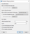
- FloodplainMapping Options.png 388 × 437; 21 KB
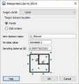
- Lidar to UGrid.png 348 × 368; 14 KB
- LidarDisplayOptions1.png 687 × 416; 19 KB
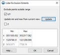
- LidarExclusionExtents.png 315 × 287; 9 KB
- LidarToRaster.png 314 × 244; 10 KB
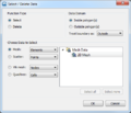
- SMS Select Delete Data.png 476 × 407; 32 KB
- SRH-2D Summary Report.png 361 × 596; 17 KB
- SWB ModelControl.png 533 × 935; 54 KB


