GMS:Add Data: Difference between revisions
From XMS Wiki
Jump to navigationJump to search
No edit summary |
|||
| Line 1: | Line 1: | ||
{{GIS links}} | {{GIS links}} | ||
==Add Shapefile Data== | ==Add Shapefile Data== | ||
The ''''' | The ''Data'' | '''Add Shapefile Data''' command allows you to browse for and open shapefiles as GIS layers in GMS. Without a license of ArcView on your computer then shapefiles are the only supported format for GIS layers. With a valid license of ArcView the ''Data'' | '''Add Data''' command is available and any of the ESRI supported formats can be opened as GIS data layers. | ||
==Add Data== | ==Add Data== | ||
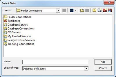
The ''''' | The ''Data'' | '''Add Data''' command is available when ArcObjects is enabled and uses the same dialog resource to open GIS data layers that is used by ArcView. | ||
[[File:Add Data Dialog.jpg|thumb|none|left|400 px|''Select Data'' dialog]] | [[File:Add Data Dialog.jpg|thumb|none|left|400 px|''Select Data'' dialog]] | ||
