GMS:Raster Catalog: Difference between revisions
From XMS Wiki
Jump to navigationJump to search
| Line 15: | Line 15: | ||
[[Image:raster_catalog4.png|none|frame|Raster surfaces.]] | [[Image:raster_catalog4.png|none|frame|Raster surfaces.]] | ||
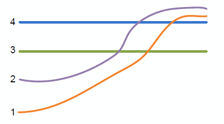
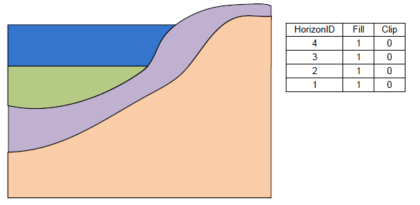
The above figure shows a slice through raster surfaces that have been indexed with horizon ids. Below we see the resulting stratigraphy if the | The above figure shows a slice through raster surfaces that have been indexed with horizon ids. Below we see the resulting stratigraphy if the ''Clip'' field is off (zero) for each raster. | ||
| Line 21: | Line 21: | ||
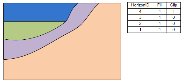
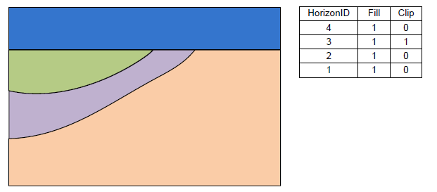
The next | The next two examples show how the stratigraphy changes when the ''Clip'' field is turned on. | ||
| Line 29: | Line 29: | ||
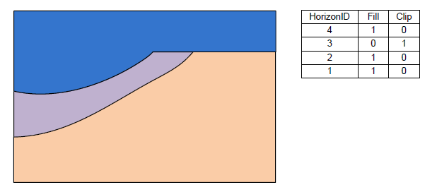
The final example shows a case where the Fill field is off and the Clip field is on. | The final example shows a case where the ''Fill'' field is off and the ''Clip'' field is on. | ||
[[Image:raster_catalog5.png |none|frame |Stratigraphy with the Fill-off and Clip-on for horizon 3.]] | [[Image:raster_catalog5.png |none|frame |Stratigraphy with the Fill-off and Clip-on for horizon 3.]] | ||
