WMS:DEM Menu
From XMS Wiki
Jump to navigationJump to search
The DEM menu contains the following options:
- Delete – Removes all DEM data
- Fill – Interpolates an elevation for the selected DEM cells.
- Smooth – Brings up the DEM Smoothing Options dialog which controls how WMS automatically rounds elevations values when a DEM is imported. See Smoothing DEMs for more information.
- Trim – See Editing DEMs for more information on the Trim commands.
- Polygon – Uses selected polygons to trim the DEM.
- Elevation – Brings up the DEM Trim by Elevation dialog. Uses a set elevation to trim the DEM.
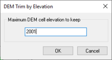
DEM Trim by Elevation dialog
- Edit Elevations – Used in conjunction with a selected DEM point or feature arc. See Editing DEM Elevations for more information.
- Point Attributes – Brings up the DEM Point Attributes dialog. See DEM Point Attributes for more information.
- Interpolate – DEM elevations can be interpolated to other objects.
- ...to 2D Grid – Elevations from the DEM can be interpolated to a 2D finite difference grid used for GSSHA models. This is accomplished using the Interpolate to 2D Grid command of the DEM menu. The DEM values will appear as a dataset under the 2D grid item in the Project Explorer.
- ...to TIN – The Interpolate to TIN command of the DEM menu is used to interpolate the elevations of the DEM to an existing TIN. If TIN vertices lie outside the bounds of the active region of the DEM, no interpolation is performed. This interpolation is done automatically when creating a TIN from feature objects and a DEM is used for a background elevation map. If trying to create a TIN from a very large DEM (large number of DEM points), it may be advantageous to create the TIN first and then interpolate elevations from the DEM in a piece-wise fashion by dividing the DEM into several smaller regions and interpolating to the TIN one at a time.
- ...to Feature Objects – Interpolates DEM elevations to feature objects on a coverage. Values will be interpolated to the active coverage.
- Conversion – Options for DEM conversion include:
- DEM Contours → Feature – See DEM Contours to Feature Objects for more information.
- DEM → TIN – See Converting DEMs to TINs for more information.

Related Topics
| [hide] WMS – Watershed Modeling System | ||
|---|---|---|
| Modules: | Terrain Data • Drainage • Map • Hydrologic Modeling • River • GIS • 2D Grid • 2D Scatter |  |
| Models: | CE-QUAL-W2 • GSSHA • HEC-1 • HEC-HMS • HEC-RAS • HSPF • MODRAT • NSS • OC Hydrograph • OC Rational • Rational • River Tools • Storm Drain • SMPDBK • SWMM • TR-20 • TR-55 | |
| Toolbars: | Modules • Macros • Units • Digitize • Static Tools • Dynamic Tools • Drawing • Get Data Tools | |
| Aquaveo | ||