Category:Noindexed pages
From XMS Wiki
Jump to navigationJump to search
Pages tagged with NOINDEX.
Pages in category "Noindexed pages"
The following 200 pages are in this category, out of 591 total.
(previous page) (next page)1
2
3
A
- SMS:ADCIRC Check/Fix Levee Crest Elevations Tool
- SMS:ADCIRC Check/Fix Levee Ground Elevations Tool
- SMS:ADCIRC Coverage 12.3 and earlier
- Template:ADCIRC Map Viewer
- SMS:ADCIRC Tools
- GMS:ADH
- SMS:ADH Bed Layers Assignment
- SMS:ADH Boundary Condition Assignment
- SMS:ADH Consolidation
- SMS:ADH Extract WSE
- SMS:ADH Hot Start Initial Conditions
- SMS:ADH Material Properties
- SMS:ADH Model Control
- SMS:ADH Model Control Advanced
- SMS:ADH Model Control Global Material Properties
- SMS:ADH Model Control Iterations
- SMS:ADH Model Control Model Parameters
- SMS:ADH Model Control Output
- SMS:ADH Model Control Solver
- SMS:ADH Model Control Time
- SMS:ADH Run Model
- SMS:ADH Sediment Library Control
- SMS:ADH Sediment Transport and Bed Layers
- SMS:ADH SMS 13.2 and Earlier
- SMS:ADH Time Series
- SMS:ADH Transport Constituents
- SMS:ADH Velocity Series Editor
- SMS:ADH Vessel Coverage
- SMS:ADH Wind Stations
- Template:Advective Courant Number
- Template:Advective Time Step
- Template:Angle Convention
- Template:Arcs from UGrid Points
- Template:Arcs to Polygons
- GMS:ART3D
- Template:Assign Spectral Data
- User:Astone/template
- User:Astone/testpage
- User:Astone/workflow testpage
- SMS:Auto-Backup Tools
B
C
- Template:Canopy Coefficient
- SMS:Cascade
- Template:Cell Dataset from Point Dataset
- Template:Cell Quality
- Template:Centroids from Polygons Tool
- Template:Check/Fix Levee Crest Elevations
- Template:Check/Fix Levee Ground Elevations
- Template:Chezy Friction
- User:Chopkin
- Template:Clean Dams Tool
- Template:Clip Raster from Elevation
- Template:Clip Tool
- User:Cmadsen/GSSHA Permafrost
- User:Cmadsen/GSSHA Workflow
- User:Cmadsen/template creation
- SMS:CMS-Flow Cell Attributes
- SMS:CMS-Flow Graphical Interface
- SMS:CMS-Flow Grid Modification Flag
- SMS:CMS-Flow Hard Bottom
- Template:CMS-Flow Hard Bottom Dataset
- SMS:CMS-Flow Observation Cells
- SMS:CMS-Flow Tidal Constituents
- SMS:CMS-Flow Time Control
- SMS:CMS-Flow Transport Control
- SMS:CMS-Flow User-Editable Datasets
- SMS:CMS-Flow/Save Points
- SMS:CMS-Wave Nesting Options Dialog
- SMS:CMS-Wave Project Workflow
- SMS:CMS-Wave Structure Types
- Template:Compare Datasets
- Template:Conservative Smoothing Filter
- Template:Contours from Raster
- Template:Contours from Single Raster Value
- Template:Convert 3D Data to 2D Data
- Template:Convert Cell Dataset to Point Dataset
- SMS:Convert From Mesh/Scatter
- Template:Convert Mesh/Scatter/Cartesian Grid to UGrid
- Template:Convert Point Dataset to Cell Dataset
- Template:Convert to 2D Mesh
- Template:Convert to Voronoi UGrid
- Template:Create Bridge Footprint
- SMS:Create Datasets
- Template:Create Locked Nodes Dataset from Coverage
- WMS:Create Reservoir (DEMs)
- WMS:Create Reservoir in DEM
- WMS:Create Reservoir in DEMs
- WMS:Create Reservoir in Digital Elevation Models
- WMS:Create Reservoirs in DEMs
- WMS:Create Storage Capacity Curves
- WMS:Creating a Storage Capacity Curve
- WMS:Creating Storage Capacity Curves
- SMS:CSHORE
- SMS:CSTORM-MS
D
- Template:D8 Flow Accumulation
- Template:D8 Flow Directions
- Template:Dataset Calculator
- Template:Dataset Calculator Table
- Template:Dataset Calculator Table Examples
- Template:Dataset to Raster
- WMS:DEM Create Reservoir
- WMS:DEM Create Reservoirs
- Template:Directional Roughness
- SMS:Dredge Source Model
- SMS:Dredging Coverage
- SMS:Dredging Material Properties Stickiness
- SMS:Dredging Scheduling
- SMS:Dredging Sediment Characteristics
- SMS:Dredging Simulations
- User:Dwood1/SMS:Version History
- User:Dwood1/WMS:Version History
- SMS:Dynamic Model Interface Schema
E
- Template:Edge Preserving Mean Filter
- Template:Edit Elevations
- SMS:EFDC Coverage
- SMS:ELCIRC
- GMS:Enabling ArcObjects
- Template:EWN Workflows
- Template:Export Curvilinear Grid
- Template:Export Horizontal Grid Tool
- Template:Export LandXML
- Template:Export tRIBS Mesh
- Template:Extend Raster
- Template:Extract Streams
- Template:Extract Subgrid Tool
- Template:Extract Submesh Tool
- Template:Extrude to 3D UGrid
- Template:Extrude UGrid
F
- Template:Feature Preserving Smoothing
- Template:Features from Raster
- GMS:FEMWATER Particle Sets
- SMS:FESWMS
- SMS:FESWMS Attributes Dialog
- SMS:FESWMS BC Nodestrings
- SMS:FESWMS executable known issues
- SMS:FESWMS Files
- SMS:FESWMS Graphical Interface
- SMS:FESWMS Hydraulic Structures
- SMS:FESWMS Material Properties
- SMS:FESWMS Menu
- SMS:FESWMS Model Control Dialog
- SMS:FESWMS Sediment Control
- SMS:FESWMS Spindown
- Template:Fill Depressions
- Template:Fill Holes in 2D Mesh
- Template:Fill Holes in UGrid
- Template:Fill Nodata
- Template:Filter Dataset
- Template:Filter Dataset Values
- SMS:Floodway Tools
- Template:Flow Accumulation Full Workflow
- SMS:FTP Site Info
G
- Template:Gaussian Filter
- SMS:Generic Grid Model
- SMS:GENESIS
- SMS:GENESIS Graphical Interface
- SMS:GENESIS Model Control Dialog
- SMS:GENESIS Observation Stations
- SMS:GENESIS Structures
- Template:Geometry Gradient
- GMS:GMS 10.0 Dialog Help
- GMS:GMS 10.1 Dialog Help
- GMS:GMS 10.2 Dialog Help
- GMS:GMS 10.3 Dialog Help
- GMS:GMS 10.4 Dialog Help
- GMS:GMS 10.5 Dialog Help
- GMS:GMS 10.6 Dialog Help
- GMS:GMS 10.7 Dialog Help
- GMS:GMS 10.8 Dialog Help
- GMS:GMS 11.0 Dialog Help
- GMS:GMS 6.5 Dialog Help
- GMS:GMS 7.0 Dialog Help
- GMS:GMS 8.0 Dialog Help
- GMS:GMS 8.1 Dialog Help
- GMS:GMS 8.3 Dialog Help
- GMS:GMS 9.0 Dialog Help
- GMS:GMS 9.1 Dialog Help
- GMS:GMS 9.2 Dialog Help
- GMS:GMS 99.99 Dialog Help
- GMS:GMS User Manual 10.0
- GMS:GMS User Manual 10.1
Media in category "Noindexed pages"
The following 13 files are in this category, out of 13 total.
- BridgeScourCoverageProperties.png 584 × 752; 33 KB
- BridgeScourDefaultOpts.png 359 × 296; 14 KB
- BridgeScourScenarioCritiVel.png 362 × 203; 9 KB
- BridgeScourSoilGeneration.png 353 × 230; 7 KB
- EditBridgeScourScenario.png 354 × 282; 12 KB
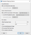
- FloodplainMapping Options.png 388 × 437; 21 KB
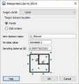
- Lidar to UGrid.png 348 × 368; 14 KB
- LidarDisplayOptions1.png 687 × 416; 19 KB
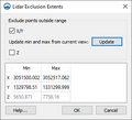
- LidarExclusionExtents.png 315 × 287; 9 KB
- LidarToRaster.png 314 × 244; 10 KB
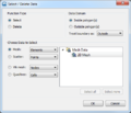
- SMS Select Delete Data.png 476 × 407; 32 KB
- SRH-2D Summary Report.png 361 × 596; 17 KB
- SWB ModelControl.png 533 × 935; 54 KB


